

3 THINGS TO KNOW
- Wildfire risk Wednesday
- Stormy Thursday, strong storms possible
- Looking chilly this weekend
FORECAST
There is a very small chance at an isolated thunderstorm south of I-80 Tuesday evening. Otherwise, it's a clear and warm evening around Omaha with temps in the 60s tonight.
The risk for wildfires increases Wednesday as gusty south winds could reach 30-35 mph. The weather stays warm with highs in the mid 80s and mostly sunny skies.
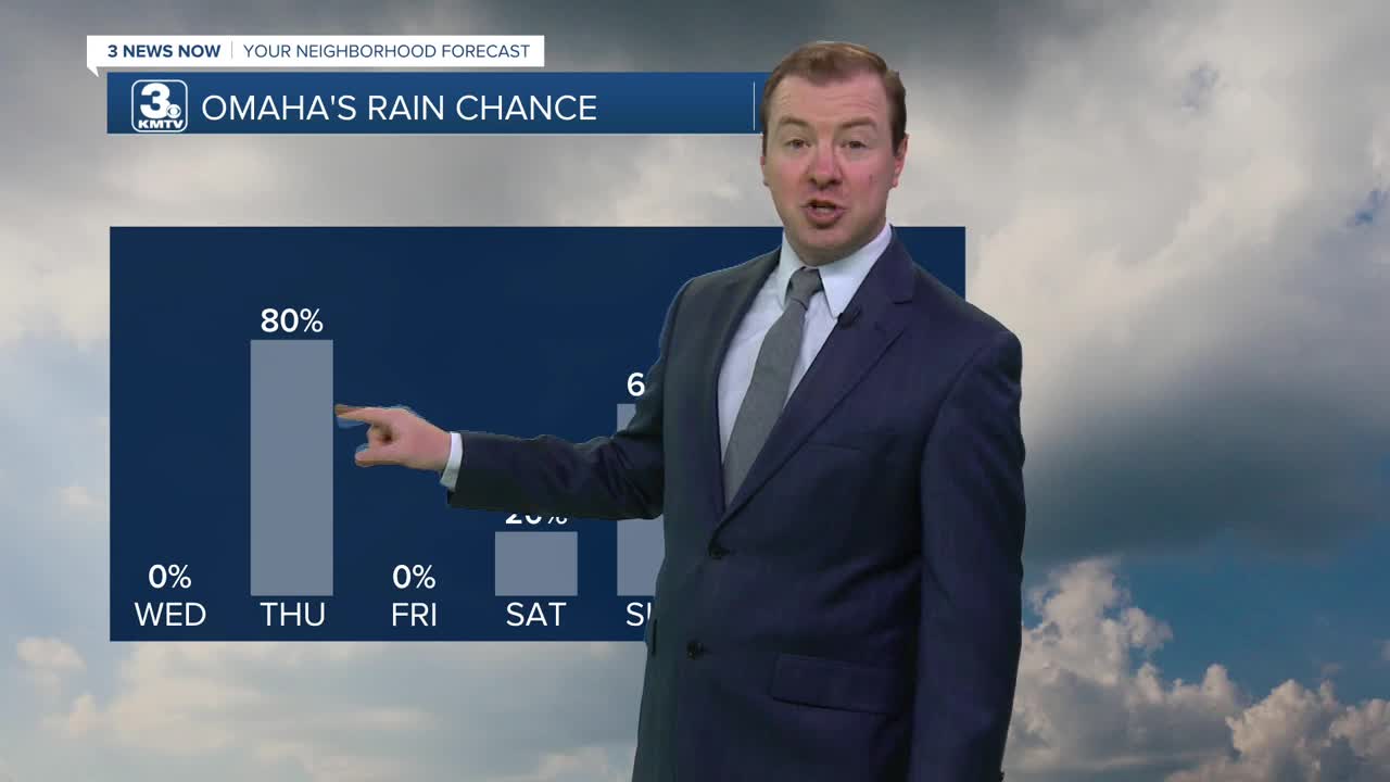
Our next cold front arrives on Thursday, bringing a chance of storms and gusty winds up to 45 mph. While there could be some rain in the morning, the best time to see storms will be after 2pm. Some of these storms from 2-8pm could be severe, with strong winds and large hail possible. 'Spin-up' tornadoes may also be possible in the late afternoon. Temperatures will be cooler, reaching the mid 70s. The rain may get heavy at times, too.
Estimated rain amounts around 0.25 to 0.50", with up to 1.00" possible by Friday morning.
Friday will be drier, sunny and cooler with highs in the 60s.
There may be more chances at rain over a chilly weekend. Saturday has a small chance at rain, followed by likely chances at rain showers on Sunday and Monday. Weekend temps will be in the low 40s at night, and near 60 during the day.
TUESDAY NIGHT
Mostly Clear
Mild
Low: 60
Wind: SW 15-20
WEDNESDAY
Mostly Sunny
Windy
High: 87
Wind: S 25-35
THURSDAY
Mostly Cloudy
Strong PM Storms
High: 77
Wind: S 30-45
Share your weather pictures with KMTV:
- Email to News@3newsnow.com
- 3 News Now Facebook page
- Use the hashtag #3NewsNow on Instagram or X (formerly Twitter)
