

Clouds move in tonight as we head for another cold night, holding in the upper 20s. We start to warm overnight with temps rising in the low 30s by Tuesday morning.
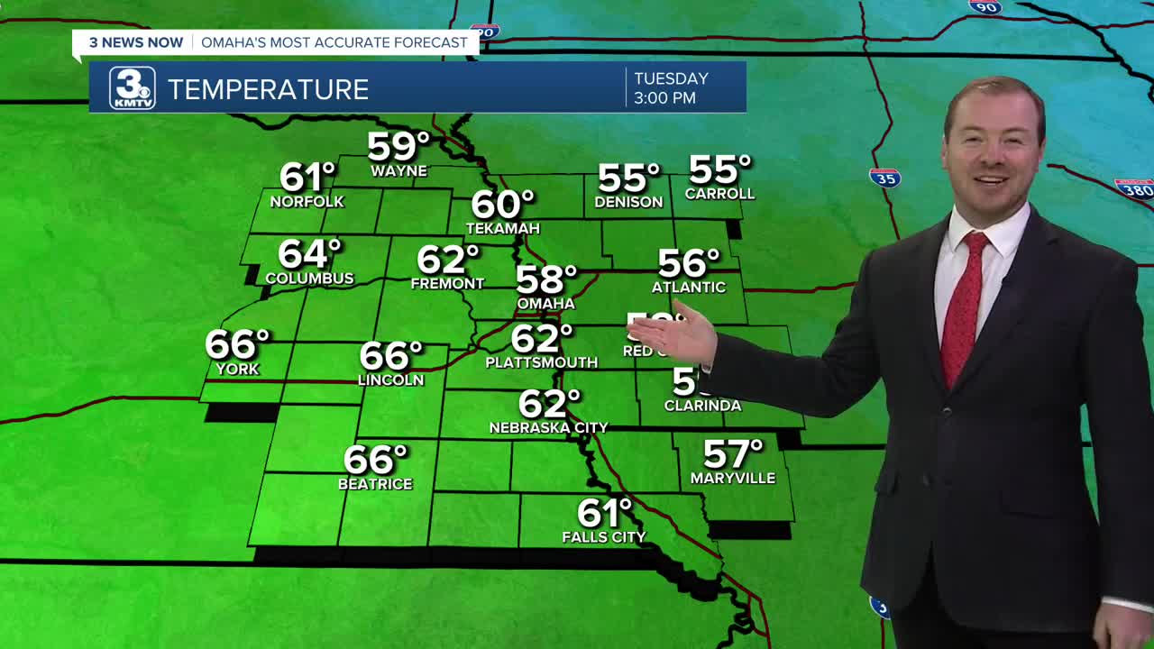
For Veterans Day, the cold snap becomes a thing of the past! After some morning cloud cover, we are back to afternoon sunshine and highs in the upper 50s across western Iowa, and low 60s across eastern Nebraska.
This begins a streak of warmer weather through the rest of the week! Each day will feature mostly sunny skies and highs in the 60s. Temperatures at night will mainly remain above freezing, around 35-40 degrees.
The warmest day this week looks to be Friday & Saturday with highs in the upper 60s, and some neighborhoods could reach 70!
Clouds will return for the weekend, bringing a small chance for rain and eventually cooler weather. There is some uncertainty on if this rain chance will stay to our south in Kansas/Missouri, or drift this way towards Omaha. For now, there is a small rain chance for southeast Nebraska and southwest Iowa on Saturday and Sunday.
We'll eventually cool back in the low 50s by Sunday and Monday of next week, which is average for this time of year.
TUESDAY
AM Clouds, PM Sun
Warmer
High: 58
Wind: W 7-15
TUESDAY NIGHT
Mostly Clear
Not As Cold
Low: 33
Wind: SW 5-15
WEDNESDAY
Mostly Sunny
Warm
High: 60
Wind: NW 5-10
THURSDAY
Partly Cloudy
Warmer
High: 65
Wind: SW 10-15
Share your weather pictures with KMTV:
- Email to News@3newsnow.com
- 3 News Now Facebook page
- Use the hashtag #3NewsNow on Instagram or X (formerly Twitter)
