

3 THINGS TO KNOW:
- Warm up early this week
- Chance at light snow Wednesday night
- Another snap of cold air hits Friday, this weekend
FORECAST:
A few light snow showers will move in this evening, providing a dusting of snow around Omaha. Roads may be a little slick from this. All of the snow clears out overnight with lows in the upper 10s for Monday morning.
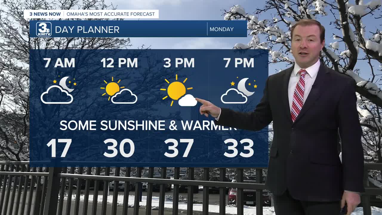
We start warming up to start next week! Monday will be partly to mostly sunny with highs in the upper 30s to low 40s.
Tuesday will be the warmest day of the week with a mix of sun and clouds, and highs into the upper 40s to near 50 degrees! Outside of snow piles, most of the snow on various surfaces will likely melt away.
A cold front will move in late Tuesday night, cooling Omaha down in the 30s for Wednesday and it will be mostly cloudy. There is a chance for some light snow Wednesday night through Thursday morning.
The cool-down doesn't stop there. We get another blast of cold air Friday, sending temperatures down to near 20 on Friday, and in the upper 10s for Saturday. Overnight temperatures will likely dip in the single digits this weekend.
Warmer weather will again return early next week, getting Omaha's high temperature back closer to normal, which is now around 39 degrees.
MONDAY
Mostly Sunny
Warmer
High: 37
Wind: S 10-20
MONDAY NIGHT
Partly Cloudy
Chilly
Low: 28
Wind: S 5-15
TUESDAY
Partly Sunny
Warmer than average
High: 50
Wind: SW 10-20
WEDNESDAY
Mostly Cloudy
Colder
Snow At Night
High: 33
Wind: NW 15-25
Share your weather pictures with KMTV:
- Email to News@3newsnow.com
- 3 News Now Facebook page
- Use the hashtag #3NewsNow on Instagram or X (formerly Twitter)
