

3 THINGS TO KNOW
- Near 32º on Wednesday
- Snow showers Thursday morning, delays possible
- Frigid air briefly returns Friday-Saturday
FORECAST
Skies will be partly cloudy tonight and it's another cooler night around Omaha with temperatures near 10 degrees by Wednesday morning.
Wednesday is our warmest day of the week. We'll see lots of morning sunshine, followed by a few afternoon clouds. Temperatures will reach the low 30s around Omaha.
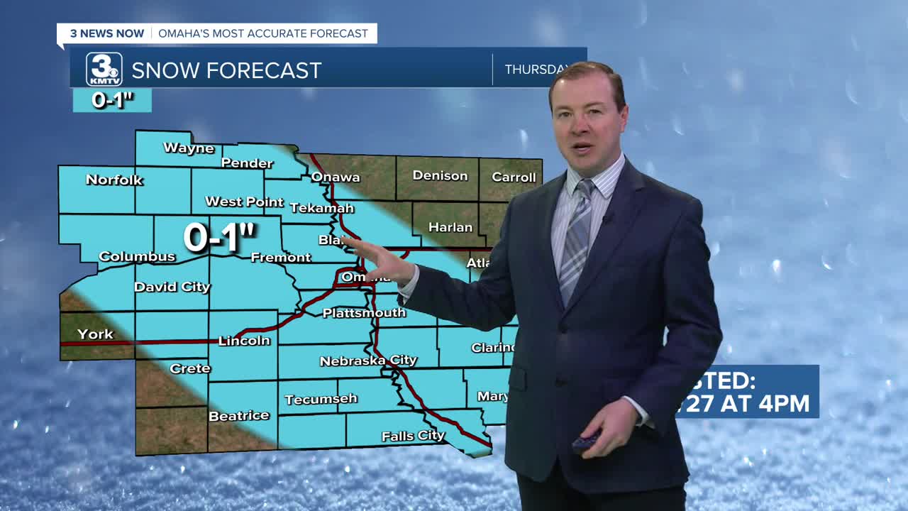
Clouds will move in Wednesday night and a few bands of snow showers will move in early Thursday morning, before 6 AM, lasting through around noon. Small accumulations of snow are now looking possible, and could impact the morning commute. Give yourself some extra time to get where you need to go Thursday.
Snow amounts will mostly stay around 1/2" to 1" around Omaha.
It starts to get cold again. Thursday's highs will be in the low 20s, followed by highs only in the 10s on Friday. We may drop below zero Friday night.
Heading into the weekend, there is another small chance for some light snow on Saturday and snow on Sunday. Some small snow amounts will be possible from this. After staying cold, in the low 20s on Saturday, Sunday will be warmer in the 30s.
If you are wanting even warmer weather, we should have that next week. Starting next Monday, temperatures will be in the 40s.
TUESDAY NIGHT
Mostly Clear
Chilly
Low: 10
Wind: NW 5-10
WEDNESDAY
Mostly Sunny
Not As Cold
High: 31
Wind: NW 5-15
WEDNESDAY NIGHT
Mostly Cloudy
Snow Showers
Low: 12
Wind: N 5-15
THURSDAY
Mostly Cloudy
Snow Showers
High: 22
Wind: NE 5-15
Share your weather pictures with KMTV:
- Email to News@3newsnow.com
- 3 News Now Facebook page
- Use the hashtag #3NewsNow on Instagram or X (formerly Twitter)
