

It stays warm and mostly clear tonight, only cooling off into the mid 60s. An average low is closer to the upper 40s right now, which we will be near next week.
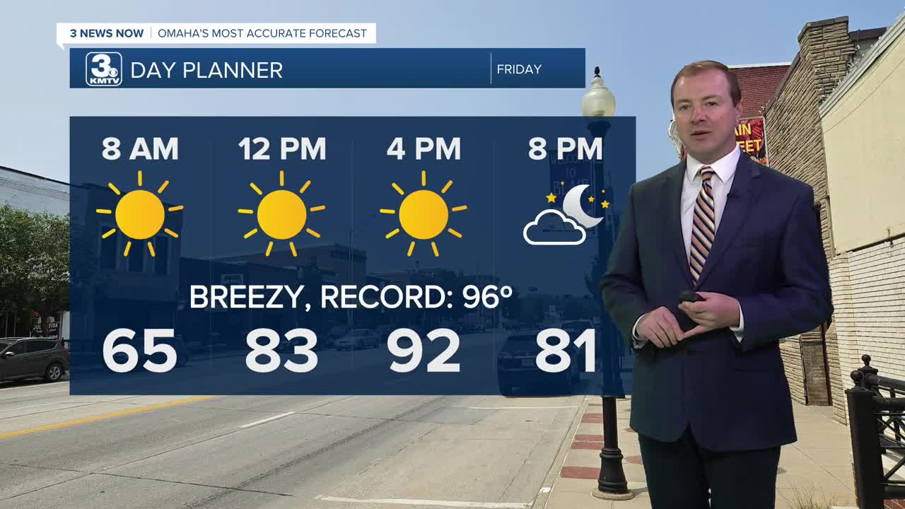
Friday will be mostly sunny and hotter with low 90s in the afternoon. The wind will get a little breezy in the afternoon, too For high school football games in the evening, those will kick off in the mid 80s, followed by upper 70s for the 4th quarter.
The wind picks up on Saturday, gusting to 35 mph at times during the day. We'll see more sunshine with highs near 90. Omaha's record high for Saturday is 92, set in 2005.
A cold front will move in from the northwest Sunday. Before it gets here, we'll likely have time to warm up into the mid 80s with a mix of sun and clouds. Later in the afternoon, the cold front will kick off some hit and miss showers and storms, which will continue into Sunday evening. Only about half of our neighborhoods will see the rain, and the rain will continue into Sunday night, mainly south of I-80.
We'll start Monday morning down in the mid 50s. Scattered showers and storms will be off-and-on Monday. It will be a cloudy and much cooler day as north winds will be gusty behind the cold front, dropping highs into the upper 60s.
There is a chance some some scattered rain will continue into Tuesday, keeping us mostly cloudy and cool. Highs will be in the upper 60s.
Clouds and rain should clear out Tuesday night, allowing temperatures to drop in the mid 40s for Wednesday morning. We warm back in the upper 60s for with sunshine for Wednesday afternoon.
FRIDAY
Mostly Sunny
Hot
High: 92
FRIDAY NIGHT
Mostly Clear
Warm
Low: 68
SATURDAY
Mostly Sunny
Windy
Record: 92 (2005)
High: 91
SUNDAY
Partly Sunny
Breezy
PM Rain
High: 86
Share your weather pictures with KMTV:
- Email to News@3newsnow.com
- 3 News Now Facebook page
- Use the hashtag #3NewsNow on Instagram or X (formerly Twitter)
