

WHAT TO KNOW:
- Warmer weather, in the 30s Friday
- Rain and snow mix Saturday
- A warming trend for next week
FORECAST:
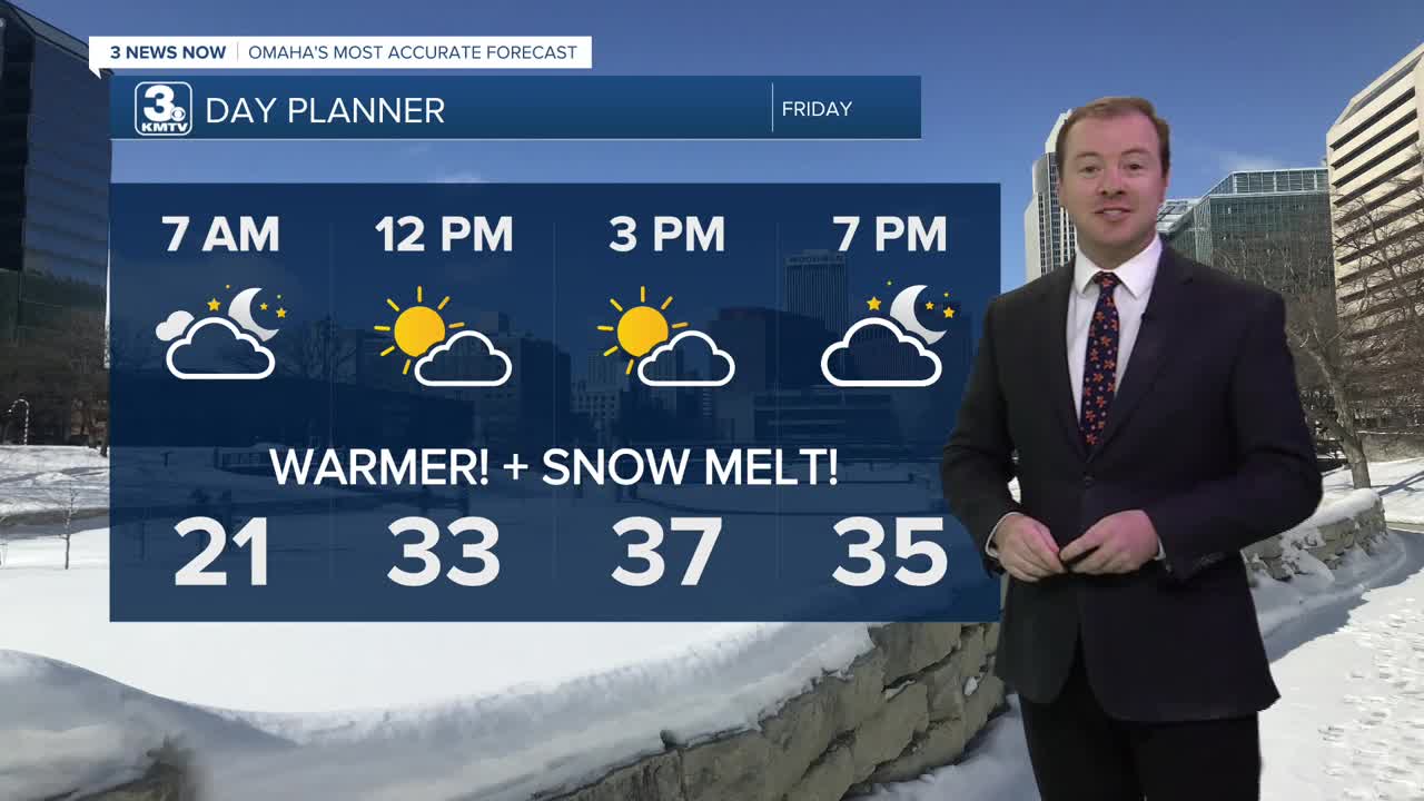
Temperatures will hold, and possibly warm overnight, reaching the low 20s by Friday morning.
Friday will be a much warmer day, and we should see a lot of snowmelt around the region. It will be partly to mostly sunny with highs in the upper 30s. Neighborhoods around Lincoln may even reach the 40s!
We stay dry and partly cloudy Friday night, dropping into the mid 20s for Saturday morning.
A 'clipper' system will roll through the region Saturday, bringing a chance at light rain and snow, followed by another quick shot of cold air. While details may change, as of right now the snow will move in Saturday afternoon and last through Saturday night. Some of the snow may mix with rain south of I-80. This includes Omaha. Amounts will be light, generally under 1" for most of us. The exception to this will be around western Iowa, closer to Denison and Carroll, where where it is mostly all snow and 1-3" of snow is possible.
By Sunday, it will be cloudy and colder. We start Sunday in the low 10s, and only warm to around 17-19 degrees. Sunday night will be frigid with lows in the single digits.
A warming trend is expected next week, and temperatures will be at or above average. What does this mean? Days are generally in the 30s and 40s. More importantly, highs above freezing.
Monday will be mostly sunny, in the mid-30s. Tuesday will be even warmer with low 40s. We do cool off a little next Wednesday and Thursday, and there is a chance at rain and snow mid-week, but highs are expected to remain in the mid-30s, above freezing.
THURSDAY NIGHT
Mostly Clear
Steady Temps
Low: 19
Wind: S 5-15
FRIDAY
Mostly Sunny
Not as Cold
High: 37
Wind: SW 5-10
FRIDAY NIGHT
Mostly Clear
A Warmer Night
Low: 23
Wind: NW 5-15
SATURDAY
Mostly Cloudy
PM Rain and Snow
High: 32
Wind: SE 5-15
Share your weather pictures with KMTV:
- Email to News@3newsnow.com
- 3 News Now Facebook page
- Use the hashtag #3NewsNow on Instagram or X (formerly Twitter)
