
Skies will clear overnight as we cool off into the mid 30s for Friday morning. We get a nice break from the stronger winds overnight, but that will be short lived.
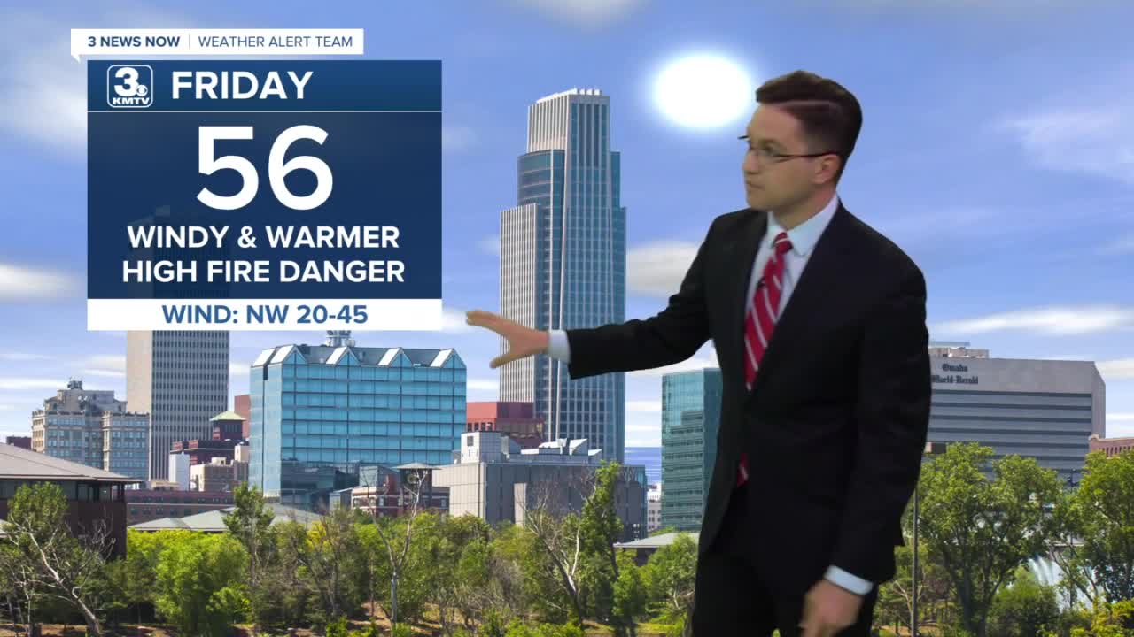
Winds quickly ramp up from the northwest Friday morning, blowing around 45 mph in the afternoon. This will create a high fire danger across the region, so avoid any outdoor burning or anything that could start a fire such as throwing a cigarette out the window.
The good news about Friday is we get to enjoy a lot of sunshine, and more seasonable weather, with highs in the mid 50s.
The weekend will be slightly cooler. Saturday will start with a lot of sunshine, but clouds start to move in for the afternoon. Highs will be near 50. Clouds continue to thicken up Sunday. Highs will be in the low 50s as we start to get a little breezy again.
We stay breezy early next week, but warm back up. Monday will be in the upper 50s with mostly cloudy skies, followed by low 60s on Tuesday.
Our next chance for widespread rain will be Tuesday and Wednesday.
Drier skies return Thursday, but temperatures struggle to warm much more.
FRIDAY
Mostly Sunny
Windy
High: 56
THURSDAY NIGHT
Clear Skies
Chilly
Low: 29
SATURDAY
Partly Cloudy
Cool
High: 50
SUNDAY
Mostly Cloudy
Breezy
High: 51
Share your weather pictures with KMTV:
- Email to News@3newsnow.com
- 3 News Now Facebook page
- Use the hashtag #3NewsNow on Instagram or Twitter
Download the free Storm Shield app for ANY type of phoneReceive severe weather watches and warnings for your location as you track the storms on radar. Great for use at the office, at home, and while traveling.
