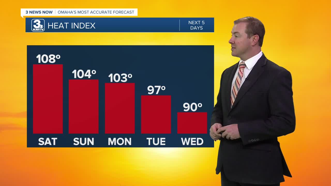


This will be a very warm evening with muggy conditions. Most, if not all of the rain in the region will stay well north of Omaha. So, we should all be dry through tonight. We'll only cool off into the mid 70s for Saturday morning.
After starting out with some clouds Saturday morning, conditions will be even hotter outside with mid 90s around Omaha. It will feel like 105+ again in the afternoon. While breezy, the wind will not be as gusty as Thursday/Friday.
Sunday brings a few more clouds, but there will still be plenty of sunshine as we reach the mid 90s. Later in the day, a few isolated showers and storms may bubble up in the afternoon heat and humidity.
Showers and storms will become more possible on Monday as a cold front begins to inch closer to Omaha. We should stay dry enough to reach the low 90s Monday afternoon before scattered storms arrive heading into Monday night.
By Tuesday, the cold front will start to move through the region, bringing a slight chance of storms. It will be partly cloudy with highs in the upper 80s.
Wednesday and Thursday begins the cool-down, and it should begin to be less humid outside by mid-week, too. Highs will be in the mid 80s through Friday, followed by low 80s heading into next weekend.
FRIDAY NIGHT
Mostly Clear
Breezy
Low: 75
SATURDAY
Mostly Sunny
Humid
High: 97
SUNDAY
Partly Sunny
Humid
Isolated Storms
High: 95
Share your weather pictures with KMTV:
- Email to News@3newsnow.com
- 3 News Now Facebook page
- Use the hashtag #3NewsNow on Instagram or X (formerly Twitter)
