

3 THINGS TO KNOW
- Windy & warmer Wednesday
- More rain Thursday
- Stormy this weekend
FORECAST
Skies will remain cloudy Tuesday evening as temps hold in the low 40s. As warmer air moves into the region overnight, temps will rise into the upper 40s and low 50s by the start of Wednesday morning.
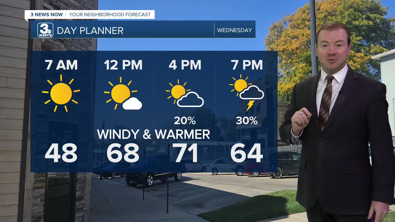
Wednesday starts out sunny and warmer, reaching 70 around noon. It gets windy, with gusts up to 40mph as a cold front arrives in the afternoon, stalling across southeast Nebraska overnight. A few isolated storms may pop up near Falls City, NE and into NW Missouri.
As the front hangs around to the south of Omaha, we could see a few round of thundershowers on Thursday. It won't rain all day, but most of us could see rain at some point on Thursday. Some pockets of hail may be possible near the stalled front to the south of Omaha. The rain moves out Thursday night and Friday stays mainly dry.
More stormy weather returns for the weekend. A few of these storms could be strong. It will be breezy with weekend and highs are expected to reach the 60s on Saturday and the 70s Sunday.
Estimated rainfall amounts will be around 0.50" to 1.00" through Sunday night.
It stays warmer than average, in the 70s on Monday, followed by cooler weather for the middle of next week.
TUESDAY NIGHT
Mostly Cloudy
Warming
Low: 46
Wind: SE 10-25
WEDNESDAY
Partly Cloudy
Afternoon Storms
Windy
High: 71
Wind: SW 25-45
THURSDAY
Cloudy
Rain & Storms
High: 59
Wind: E 5-10
Share your weather pictures with KMTV:
- Email to News@3newsnow.com
- 3 News Now Facebook page
- Use the hashtag #3NewsNow on Instagram or X (formerly Twitter)
