

3 THINGS TO KNOW
- Windy, warmer Wednesday
- Dangerous cold Friday, Saturday
- Small chances at snow this weekend
FORECAST
It will be a partly to mostly cloudy night, and there may be a few pockets of snow flurries. We start Wednesday morning near 20 degrees.
We get a quick warm-up Wednesday as a warm front moves through in the morning, jumping us into the 30s to low 40s in the afternoon, and there should be some sunshine.
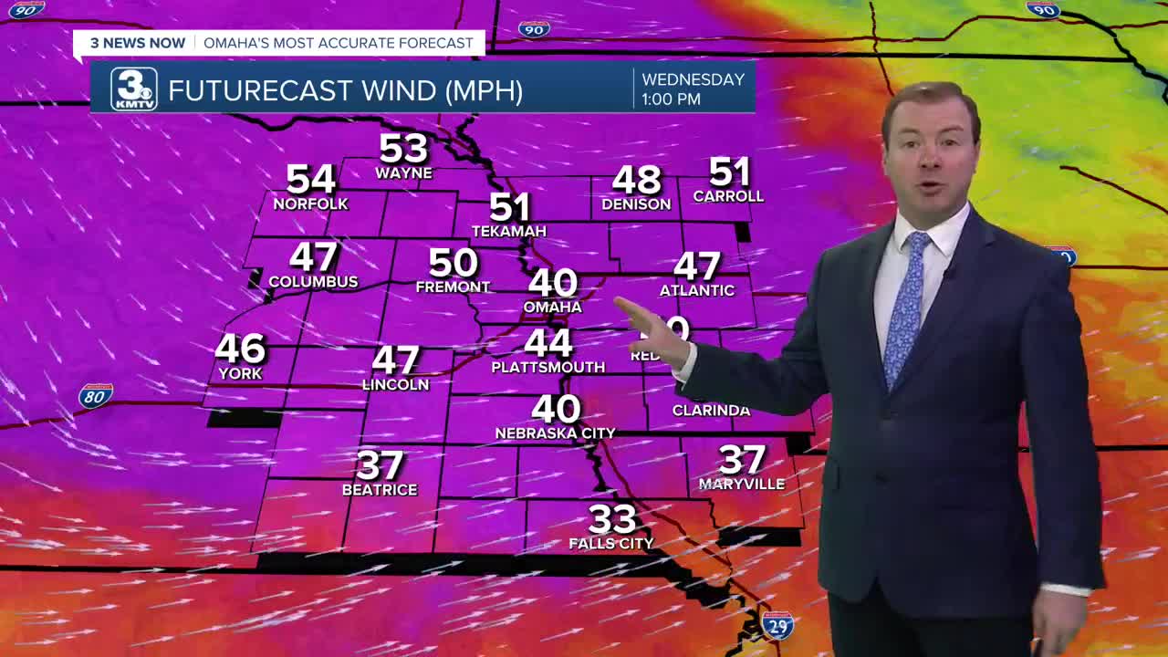
Starting in the afternoon, northwest winds will begin to pick up as a cold front starts to move through the region. The winds could gust to as high as 50 mph on Wednesday afternoon. By Wednesday night, it's cold again with lows in the mid 10s.
Thursday will be partly sunny, cooler and breezy with highs in the low 30s.
Even cold air will move into the region by the end of the week, and it becomes dangerous Friday. Temperatures will dip below zero Friday morning, with wind chills around -20 to -30. The wind will not be overly strong, it's just THAT COLD!
Friday is the coldest day with a high of around 4. Friday night will drop below 0 once again.
There is a chance we could see a few snow showers Friday night and Saturday, but a strong high pressure system moving in from Canada may reach us first, leaving the Omaha region just cold and dry. Areas south of Omaha may only get a dusting of snow.
By the end of the weekend, temperatures will start to recover, reaching the 20s on Sunday and the 30s by next Monday.
TUESDAY NIGHT
Partly Cloudy
Cold
Low: 20
Wind: SW 5-15
WEDNESDAY
Partly Cloudy
Snow Flurries
Windy
High: 43
Wind: S 30-50
THURSDAY
Partly Cloudy
Seasonal
High: 32
Wind: NW 10-25
Share your weather pictures with KMTV:
- Email to News@3newsnow.com
- 3 News Now Facebook page
- Use the hashtag #3NewsNow on Instagram or X (formerly Twitter)
