

When creating a seasonal forecast, we must first diagnose what is happening with our oceans and our global climate trends!
Will we have lots of snow this winter?
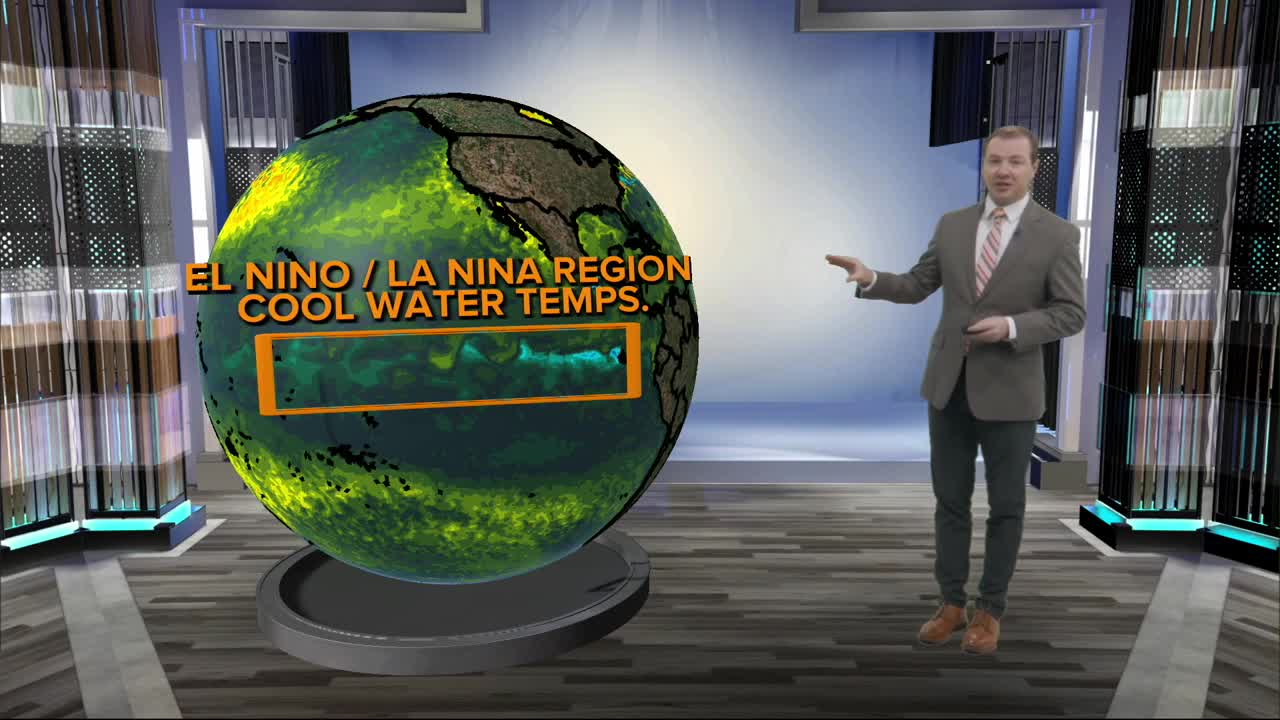
El Nino/La Nina: Currently, we are in a weak La Nina where cooler than normal water temperatures have been observed along the equator of the eastern Pacific Ocean. This has been the pattern since the summer of 2024.
Typically, this pattern leads to slightly warmer conditions for Omaha. During our winters, stronger La Nina patters tend to lead to warm winters. Weaker La Nina years lead to mild Omaha winters, but that may change this year thanks to some other factors at play, including the potential of El Nino forming sometime next year.
Prior to this, we had a long-lived moderate La Nina from 2020 to 2023. A strong El Nino formed by mid- 2023, before fading in early 2024 to the pattern we are in now.

Omaha's snowfall numbers have been down over the last 5 years, reaching totals of around 15-20 inches. The winter of 2020-2021 was the last season that experienced above normal snowfall, and it was very snowy, at 48.0 inches at Eppley!
On years when El Nino/La Nina switches phase, we see climatic shifts in temperature and precipitation.
North Pacific: We currently have warmer than normal water temperatures over the northwest Pacific Ocean, and cooler than normal waters over the northeastern Pacific Ocean. This has been the general pattern since early 2021.
This current pattern leads to a stronger, more energized jet stream southwest of Alaska, but a weaker, less energized jet stream across the western United States/North America. These effects become more enhanced when we are in a La Nina pattern.
More of Omaha's storm systems arrive from the north, not the south during this pattern. Lots of 'clipper' systems! Which bring, brief, light snows and cold air, followed by stretches of warmer and dry weather. This can lead to slightly lower winter precipitation total for the region.

Our pattern over the last 5-7 years has been mostly dominated by this -PDO pattern. We tend to have less "snow days", or days when 0.1" or more is observed at Eppley during these patterns.
North Atlantic: We currently have warmer than normal water temperatures over the northern Atlantic Ocean, although these waters have cooled slightly this year compared to last year. Yes, the Atlantic is a LONG WAY away from Omaha, but this has been shown to lead to longer/shorter-lived severe cold snaps over the Midwest. Studies from the University of Nebraska have shown this also can affect Nebraska's drought conditions.
Since the mid 2010s, these waters have been warmer than normal, and Omaha's winters have been slightly warmer than normal over this time period. During this time, the trend is to have less 'cold snap days', or days where the temperature falls below zero.
What do you think we will have this year?
Download our apps today for all of our latest coverage.
Get the latest news and weather delivered straight to your inbox.
