
Mostly clear skies expected tonight. We will be running warmer to start Friday than we have most of this week - in the mid to upper 50s.
By Friday morning, more clouds will be pushing back in as another weak cold front moves through the region. The clouds don't let us cool off as much, so we start Friday in the upper 50s.
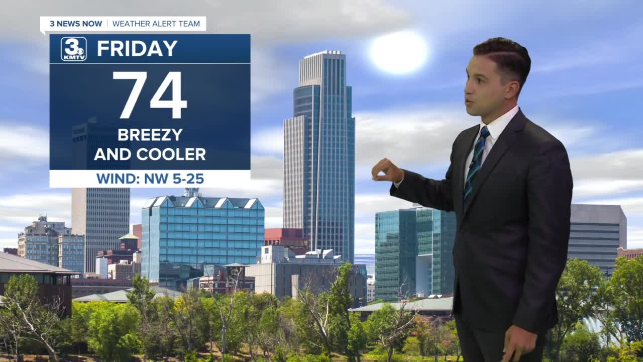
Friday afternoon brings more clouds than sunshine and a little cooler weather. While an isolated shower can't be ruled out, most stay dry. Highs will be in the mid 70s.
Temperatures rebound over the weekend with mostly sunny skies. Saturday will be in the upper 70s, which is average for late September, but then we warm into the upper 80s on Sunday.
The heat keeps building to start the next workweek. Monday will be near 90 degrees, but temperatures slide back a bit into the middle of next week.
FRIDAY
Mostly Cloudy
Some Sprinkles
Breezy
High: 74
FRIDAY NIGHT
Gradually Clearing
Some Sprinkles
Low: 48
SATURDAY
Mostly Sunny
Warm
High: 78
SUNDAY
Mostly Sunny
Warmer
High: 87
Share your weather pictures with KMTV:
- Email to News@3newsnow.com
- 3 News Now Facebook page
- Use the hashtag #3NewsNow on Instagram or Twitter
Download the free Storm Shield app for ANY type of phoneReceive severe weather watches and warnings for your location as you track the storms on radar. Great for use at the office, at home, and while traveling.
