

We continue to warm up today with highs in the mid 80s and a mix of sun and clouds. There will be a few spotty, mainly light, showers through the afternoon, but a lot of us will still be dry into the evening commute
As a cold front arrives from the north this evening, hit and miss storms will become more likely. A couple of these could reach severe levels with extra large hail and damaging wind being the main concerns. While a tornado is possible, it is not likely. The most likely time for a severe storm or two in our area will be from 7 p.m. to midnight, but there could be one a little sooner or later. If a heavy pocket of rain gets stuck over an area, we could see some brief flash flooding in a couple neighborhoods.
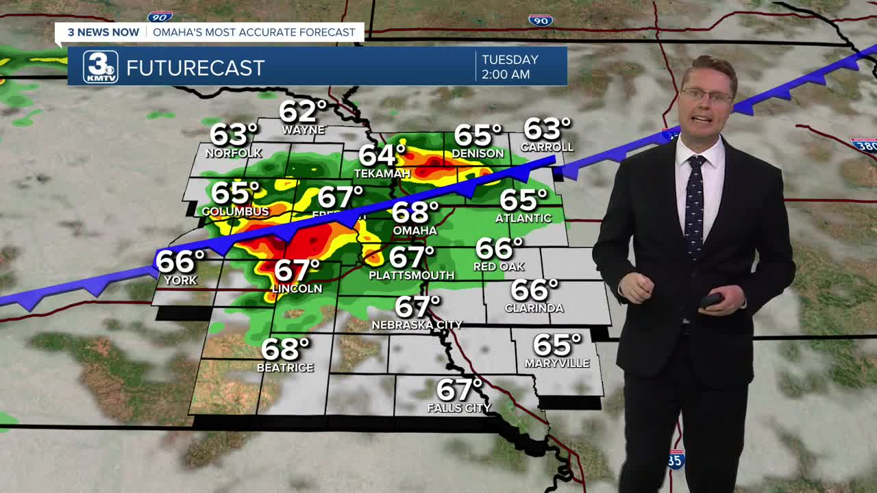
The storms will weaken overnight, ending the severe storm threat, but some of the rain will continue into Tuesday morning as we cool off into the mid 60s.
Scattered showers and storms will continue at times Tuesday afternoon and evening, especially along and south of I-80. The cooler air blowing in behind the cold front and the clouds will help to keep highs in the upper 60s and low 70s across eastern Nebraska and western Iowa.
Wednesday will likely be dry with a mix of sun and clouds. It will be comfortable with lower humidity and highs in the mid 70s.
It will be mostly sunny with upper 70s on Thursday, kicking off a stretch of sunny and dry weather.
We could get back to 80 in Omaha on Friday with a lot of sunshine.
The low 80s continue Saturday and Sunday with mostly sunny skies.
MONDAY
Partly Cloudy
Spotty Storms Late
High: 84
MONDAY NIGHT
Mostly Cloudy
Rain & Storms
Low: 64
TUESDAY
Mostly Cloudy
Scattered Rain/Storms
High: 73
WEDNESDAY
Partly Cloudy
Likely Dry
High: 76
Share your weather pictures with KMTV:
- Email to News@3newsnow.com
- 3 News Now Facebook page
- Use the hashtag #3NewsNow on Instagram or X (formerly Twitter)
