

3 THINGS TO KNOW
- Windy and cooler Friday
- Friday's rain chance now is low
- Patchy frost possible Sunday morning
FORECAST
Halfway through this morning, a cold front slipped through our area, causing winds to shift from SW to NW, and our temps to drop from the 70s this morning to now lower 50s.
The severe weather risk for afternoon storms will be focused south and east of Omaha, and will exit the region by 4pm. All types of severe weather are possible. While Omaha and most of the region now likely stays dry, we could see storms near Maryville, Missouri and Clarinda, Iowa in the 2-4pm range.
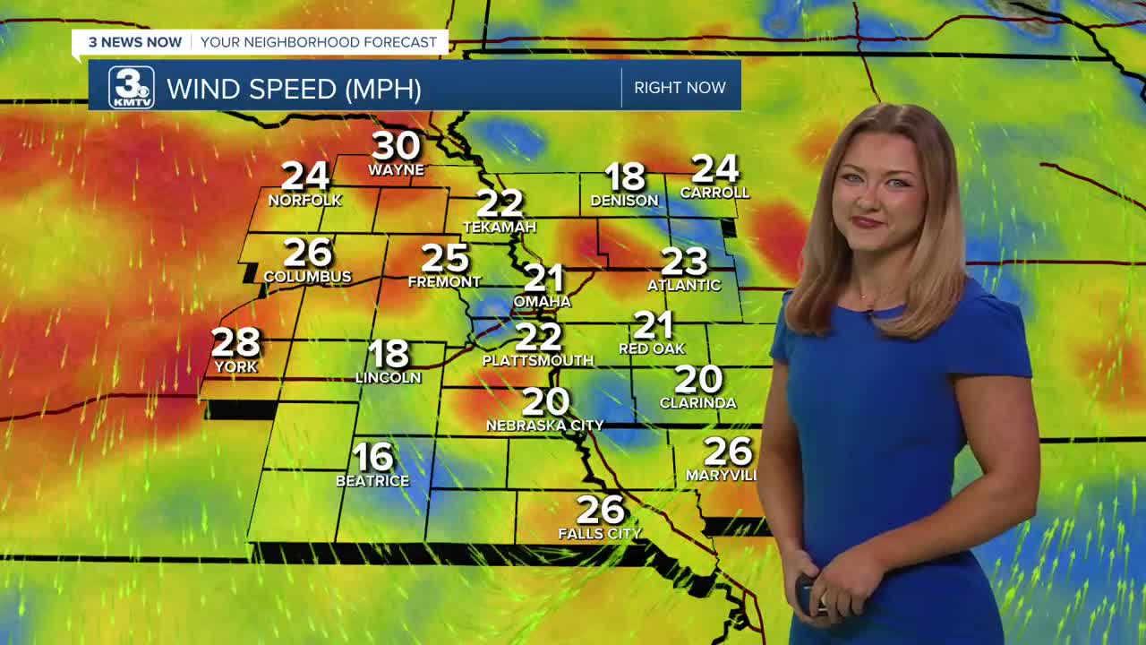
It stays windy and cooler for Friday night with gusts up to 45mph. Temps will dip in the 30s for Saturday morning, and highs in the mid 50s for Saturday afternoon.
As winds settle Saturday night and skies remain clear, areas of patchy frost and freezing conditions are expected. Sunday morning will be around 29-33 degrees.
Sunday and next Monday will be dry, sunny and warmer with highs in the 60s and 70s. There may be some returning rain towards the end of next week, but this will be a drier pattern over the next 7 days.
FRIDAY
Partly Cloudy
Windy and Dry
4 PM: 55º
Wind: S to NW 25-45
FRIDAY NIGHT
Partly Cloudy
Mild
Low: 34
Wind: SW 15-25
FRIDAY
Partly Cloudy
Little Cooler
High: 53º
Wind: NW 25-35
Share your weather pictures with KMTV:
- Email to News@3newsnow.com
- 3 News Now Facebook page
- Use the hashtag #3NewsNow on Instagram or X (formerly Twitter)
