

3 THINGS TO KNOW
- Several days in the 80s next week
- High fire danger midweek
- Small storm chances by the weekend
FORECAST
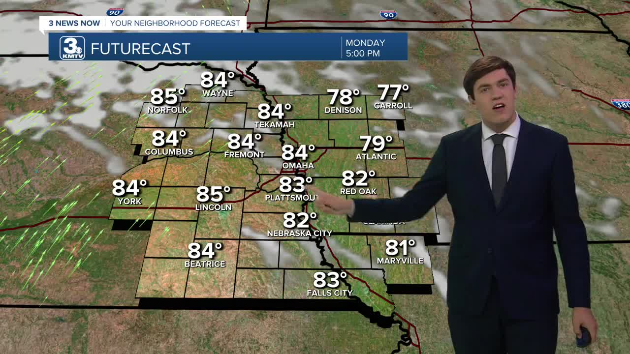
We begin to warm up by Monday as highs jump into the mid-80s with more sunshine.
A passing cool front on Tuesday may bring in some extra wind and a sprinkle or two, but most will be dry. Highs on Tuesday still reach the low 80s.
The impact from the front is to drop the temperature a few degrees on Wednesday, but we still hit the low 80s.
The wind returns on Thursday (30-40 mph), which may heighten fire danger; avoid any outdoor burning. Highs will reach the upper 80s.
We get even warmer on Friday, with a few neighborhoods hitting the 90s. We stay very warm on Saturday too, with a high of 89.
Each day from Thursday to Saturday may bring a small storm chance, but most of us will be dry through the next 7 days.
MONDAY
Partly Sunny
Warmer
High: 84
Wind: SE 5-15
MONDAY NIGHT
Mostly Clear
Mild
Low: 60
Wind: SW 5-10
TUESDAY
Partly Sunny
Breezy
High: 82
Wind: SW 10-25
WEDNESDAY
Sunny
Warm
High: 83
Wind: NW 5-15
Share your weather pictures with KMTV:
- Email to News@3newsnow.com
- 3 News Now Facebook page
- Use the hashtag #3NewsNow on Instagram or X (formerly Twitter)
