

3 Things to Know
- Sunday is trending wet and stormy
- Next week looks hot & humid
- Midweek storms and wind
Forecast
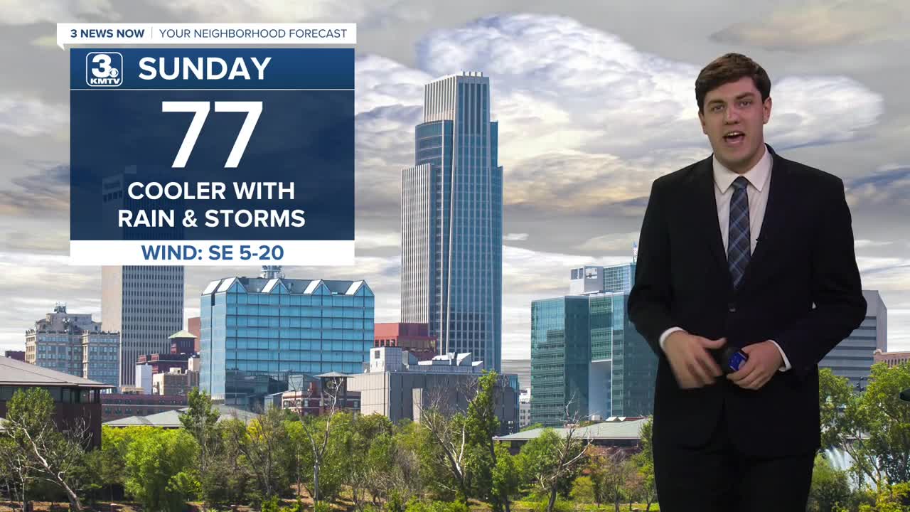
More rain and storms return on Sunday. While it will not rain all day, we could see periodic rain/storms throughout the day, particularly over western Iowa. The severe risk is low with any storm, but some small hail is possible in a few of the stronger ones. Highs will be cooler, in the upper 70s.
We dry out early next week, which allows the heat to return. Monday will reach the upper 80s, with the humidity, it will feel like the 90s.
Barring an evening storm or two, Tuesday also looks dry, but it will be hot. Temperatures will climb into the mid-90s, with the heat index at or just above 100. While its not uncommon in the summer, it may be a good time to review those heat safety precautions with your loved ones before any extended periods spent outside.
On Wednesday, we reach the peak of the heat with highs in the mid-90s and a heat index above 100. The heat will be aided by a strong southerly wind up to 40 mph at times. An evening cold front could bring relief in the form of some storms. Unfortunately, we will have to be on guard for a severe risk with a few of these thunderstorms.
We start to trend backward in temperatures for Thursday, with highs down into the upper 80s. A few storms may hang around Thursday morning, and perhaps more in the evening.
By Friday, we are back to "average" temperatures for the opening day of the College World Series. Highs will be in the low 80s with the chance of an isolated storm or two.
SUNDAY
Mostly Cloudy
Rain & Storms
High: 83
Wind: SE 5-20
SUNDAY NIGHT
Mostly Cloudy
Patchy Fog
Low: 69
Wind: SE 5-10
MONDAY
Partly Cloudy
Hot & Humid
PM Spot Storms
High: 90
Wind: S 5-10
TUESDAY
Partly Sunny
Warm & Humid
PM Spot Storms
High: 90
Wind: SE 5-10
Share your weather pictures with KMTV:
- Email to News@3newsnow.com
- 3 News Now Facebook page
- Use the hashtag #3NewsNow on Instagram or X (formerly Twitter)
