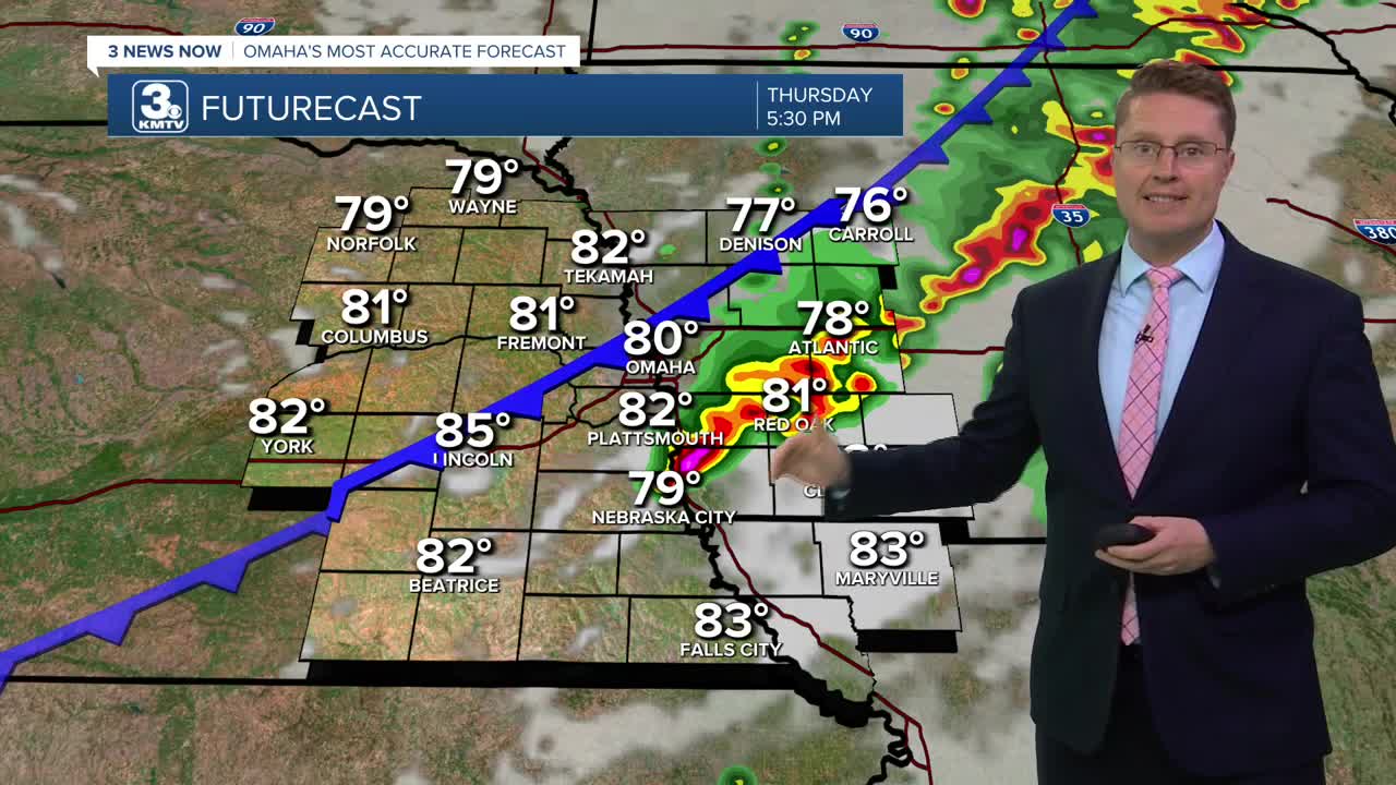


Early this afternoon, a line of storms will start to form north of I-80, which will then work its way southeast the rest of the day. If the storms form quickly enough, they'll likely hit the Omaha metro around 2-3 this afternoon. This will keep us in the low 80s. Neighborhoods west of Omaha have a better chance of staying dry. The storms should be southeast of Omaha by the evening commute, and it could take until 9 p.m. for the storms to clear northwest Missouri.
Skies will clear overnight, but foggy areas are possible heading into the Friday morning commute as we cool off into the mid and upper 60s.
Friday will be mostly sunny and warmer with upper 80s and plenty of humidity. We'll still be in the upper 80s as the Memorial Park Concert gets underway. There is a slim chance of an isolated shower making it into eastern Nebraska late in the day, but it will very likely be dry at Memorial Park. By the fireworks around 10 p.m., we will be in the low 80s.
We heat up into the mid 90s Saturday with mostly sunny skies. An isolated storm could pop up late in the day, but a lot of us will be dry.
It should be dry long enough for us to hit 90 on Sunday, but showers and storms are likely heading into Sunday evening and night.
There could be a couple leftover showers around Monday, but most of us will be dry with upper 80s.
The upper 80s will continue Tuesday and Wednesday with a lot of sunshine.
THURSDAY
Mostly Cloudy
Rain & Storms
High: 83
THURSDAY NIGHT
Clearing Skies
Foggy Areas
Low: 68
FRIDAY
Mostly Sunny
Likely Dry
High: 88
SATURDAY
Mostly Sunny
Hot
High: 94
Share your weather pictures with KMTV:
- Email to News@3newsnow.com
- 3 News Now Facebook page
- Use the hashtag #3NewsNow on Instagram or X (formerly Twitter)
