

3 THINGS TO KNOW
- Rain begins Wednesday afternoon
- More rain Thursday and Friday
- Near-average temps through Easter
FORECAST
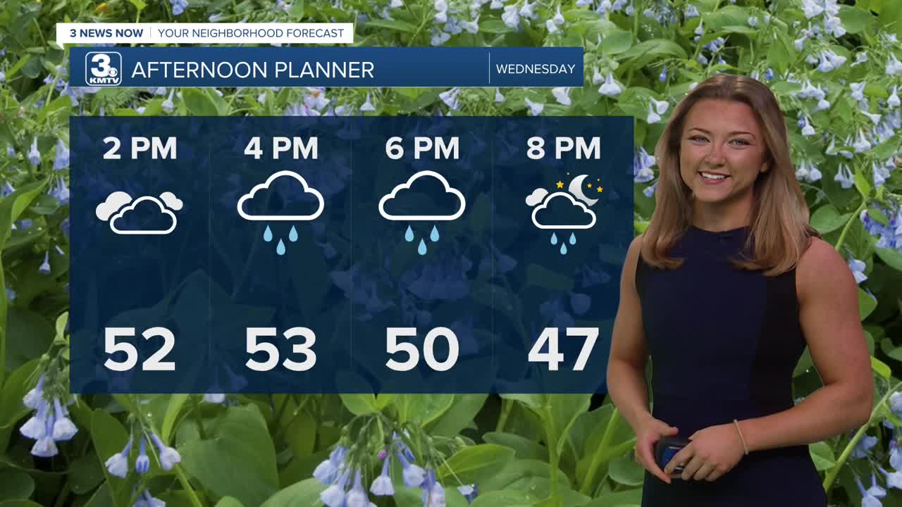
Wednesday will be our first of several rounds of rain for this week. The day starts out mostly cloudy and cloudy with temps holding in the 50s. Heading into Wednesday afternoon, a few spotty rain showers will begin to pop up. This rain will become widespread by evening and will last through Thursday morning. We could see 0.5" to 0.50" of rain from this round.
Some rain will linger into Thursday morning, but by the afternoon, it's trending drier with highs in the mid 50s.
More rain moves in for Friday, and a few thunderstorms may be possible, too. Some of this rain may become heavier at times, and there is a small chance at severe weather. Friday's temps will reach the upper 50s.
By Friday night, may rain gauges may show 0.50" to 1.50" in it.
It's now looking like the rain will clear out before the weekend, leaving Saturday drier, but cooler and windy with highs in the upper 40s.
For your Easter Sunday plans, expect a cold morning in the upper 20s, followed by temps in the mid 50s with sunshine and calmer winds in the afternoon.
Our pattern becomes drier and warmer again to start next week.
WEDNESDAY
Mostly Cloudy
Rainy
High: 50
Wind: E 15-20
WEDNESDAY NIGHT
Mostly Cloudy
Stormy
Low: 38
Wind: N 15-20
THURSDAY
Mostly Cloudy
Dry Afternoon
High: 53
Wind: E 15-20
Share your weather pictures with KMTV:
- Email to News@3newsnow.com
- 3 News Now Facebook page
- Use the hashtag #3NewsNow on Instagram or X (formerly Twitter)
