

3 THINGS TO KNOW
- Strong winds and bitter cold for Monday morning
- Another pass of light rain/snow on St. Patrick's Day
- A big warm-up arrives midweek with our first 80s of the year
FORECAST
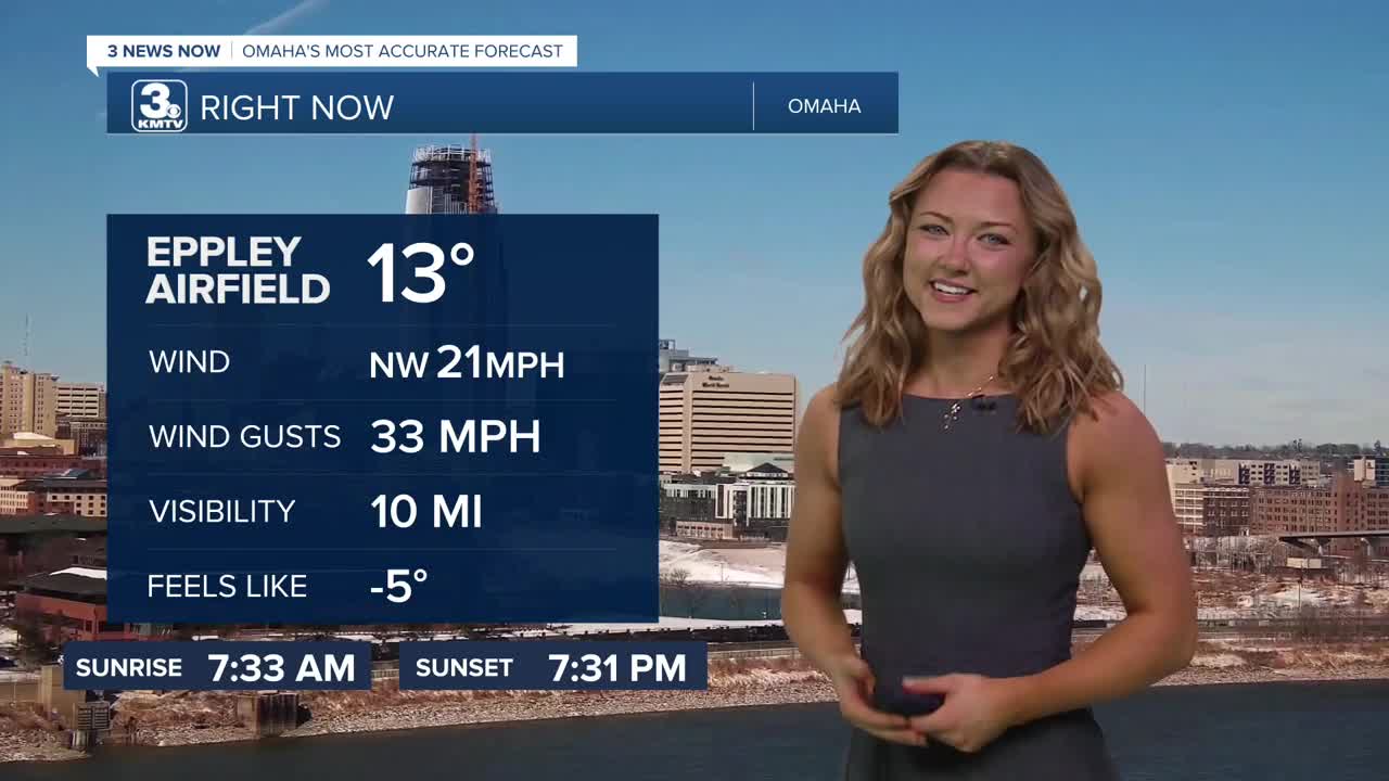
Though the snow is gone, the wind will stick around as temperatures continue to crash. Monday's weather definitely isn't what most would choose to start the week with, as temps are starting out only in the single digits. Combined with a 30-40 mph wind, wind chills could drop to -15 in the morning.
The sun returns on Monday, but it's still cold with highs in the mid-20s. The wind will persist, with gusts of 35-45 mph, but will gradually ease throughout the day. Wildfire conditions will once again become the story on Monday due to the strong winds and very low humidity.
Clouds move back in on Tuesday as another storm system slides by. This one does not look to be windy. Some of us could get a quick burst of rain or snow, but it looks light enough not to cause many impacts. Highs on Tuesday are warmer, in the 30s and low 40s.
Warmer weather kicks into high gear on Wednesday with the return of the 70s!
It may be hard to believe after Sunday's blizzard, but we could hit our first 80s of the year on Friday!
MONDAY
Mostly Sunny
Breezy
High: 23
Wind: NW 25-35
MONDAY NIGHT
Mostly Clear
Frigid
Low: 10
Wind: NW 20
TUESDAY
Mostly Cloudy
Rain and Snow
High: 40
Wind: S 10-20
WEDNESDAY
Partly Cloudy
Warmer
High: 69
Wind: N 5-10
Share your weather pictures with KMTV:
- Email to News@3newsnow.com
- 3 News Now Facebook page
- Use the hashtag #3NewsNow on Instagram or X (formerly Twitter)
