

WHAT TO KNOW:
- Near 32º Tuesday with some snow melt
- Windy and colder on Wednesday
- BRISK Thursday morning, below zero
- More light snow on Saturday
FORECAST:
We'll start Tuesday morning in the single digits, with some patchy fog in low-lying spots.
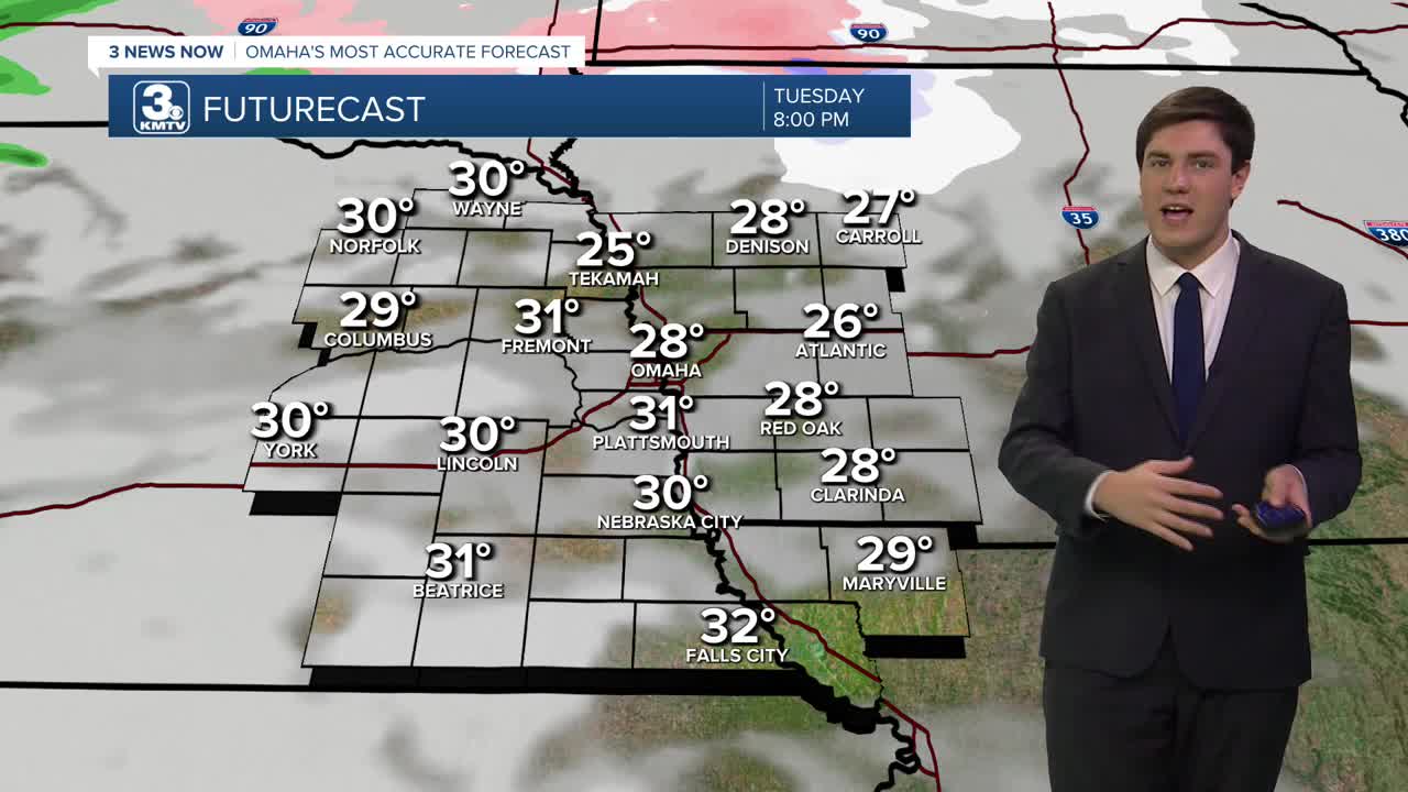
Tuesday will be mostly sunny, but some fog lifting in the morning may add a layer of clouds during the day. Regardless, it's a warmer day near freezing, which should help melt snow off roads. This snow melt will re-freeze on Tuesday night.
A strong cold front on Wednesday morning will bring windy conditions and cause the temperatures to be "flipped", meaning we are the warmest in the morning and colder throughout the day. As you head out to work or school, it will be in the low 30s. As you head home, it will have dropped into the upper 10s.
We bottom out on Wednesday night with lows around -5 degrees, the first time this season we will drop below 0. The wind should quickly calm on Wednesday night, so Thursday morning's wind chill will only be down around -15 to -10.
Thursday will be sunny, but cold with highs in the upper 10s.
We slowly climb out of the bitter cold by the end of the week and into the weekend, with low 30s on Friday and Saturday.
Another storm system could impact the region with light snow on Saturday, possibly bringing rain and snow. At this time, it doesn't look as impactful as the winter storm we had this past weekend, and we should be back to a little sunshine by next Sunday.
TUESDAY
Partly Sunny
Not As Cold
High: 33
Wind: S 5-10
TUESDAY NIGHT
Mostly Cloudy
Chilly
Low: 27
Wind: S 5-15
WEDNESDAY
Cloudy, Snow Flurries
Falling Temps
Breezy
8 AM Temp: 30
4 PM Temp: 18
Wind: NW 25-35
THURSDAY
Mostly Sunny
Frigid
High: 19
Wind: N 5-15
Share your weather pictures with KMTV:
- Email to News@3newsnow.com
- 3 News Now Facebook page
- Use the hashtag #3NewsNow on Instagram or X (formerly Twitter)
