

3 THINGS TO KNOW
- Sunshine for beginning of week
- Warm weather with some fire risk
- Storms return Thursday
FORECAST
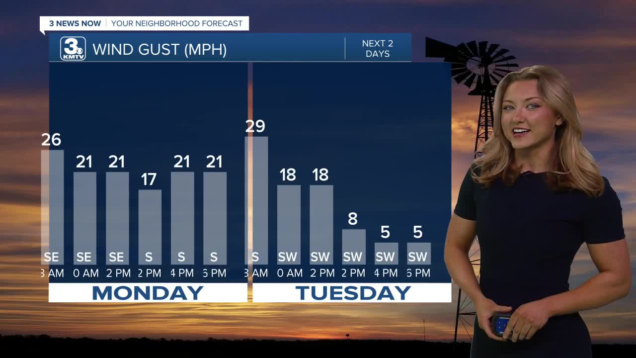
We get warmer on Monday, with highs in the upper 70s, aided by the return of southerly winds (20-30 mph). The combination of wind, warmth, and dry conditions will create some fire danger. Avoid any outdoor burning.
Tuesday, we jump another 10 degrees, into the upper 80s. The wind is lower, and thus the fire risk is a bit lower too.
The fire weather risk returns on Wednesday as the wind returns (30-40 mph), temperatures hold in the upper 80s, but some humidity will begin to return to the area too.
Our next cold front arrives on Thursday, bringing a chance of storms. Depending on the ingredients, severe weather is possible, but it's too early for any specifics.
The cold front knocks back our temperatures for Friday into the weekend, with highs in the low 60s and lows in the 30s.
MONDAY
Mostly Sunny
Warm & Breezy
High: 78
Wind: SE 20-30
MONDAY NIGHT
Mostly Clear
Not as Cold
Low: 53
Wind: SE 5-10
TUESDAY
Sunny
Very Warm
High: 87
Wind: SW 5-15
WEDNESDAY
Partly Cloudy
Windy
High: 86
Wind: S 25-35
Share your weather pictures with KMTV:
- Email to News@3newsnow.com
- 3 News Now Facebook page
- Use the hashtag #3NewsNow on Instagram or X (formerly Twitter)
