

3 THINGS TO KNOW
- Windy for Tuesday
- A wetter pattern this week
- Temperatures seesaw between 50s and 60s
FORECAST
Waking up this morning, you might've felt a little warm! That cloud coverage we had last night was able to trap a lot of heat from yesterday, which is why we're still seeing the upper 60s as we're waking up!
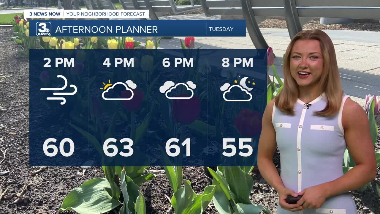
It gets breezy by early Tuesday morning as a cold front moves into the region. We'll stay mostly cloudy and breezy on Tuesday, with 50s in the morning and low 60s in the afternoon.
Wednesday will be our first of two rounds of rain for this week, and the whole day may be rainy. With the clouds and rain, temperatures will be colder, in the 40s. There is a chance some melting snow mixes in with the rain far north of Omaha, where air temps will be in the 30s all day. This rain mostly comes to an end Wednesday night.
Some rain may linger into Thursday. Otherwise its cloudy and staying cool with temps in the upper 40s.
More rain moves in for Friday, and a few thunderstorms may be possible, too. Some of this rain may become heavier at times. Friday's temps will reach the 50s to low 60s.
We want to be careful not to promise this much rainfall, but the models are giving the region around 0.50" to 1.50" of rain this week. Some could see more.
This rain will continue into Saturday morning of this upcoming Easter weekend, but the second half of Saturday is trending drier, just cloudy.
For now, Easter Sunday looks partly cloudy and mostly dry, in the mid 50s which is near normal for early April.
TUESDAY
Mostly Cloudy
Breezy
High: 65
Wind: N 20-25
TUESDAY NIGHT
Mostly Cloudy
Cooler
Low: 38
Wind: N 15-20
WEDNESDAY
Mostly Cloudy
Rainy
High: 49
Wind: E 15-20
Share your weather pictures with KMTV:
- Email to News@3newsnow.com
- 3 News Now Facebook page
- Use the hashtag #3NewsNow on Instagram or X (formerly Twitter)
