The cold front moved southward, keeping us in the 30s during the day. Clouds start to move in overnight as we cool into the mid 20s.
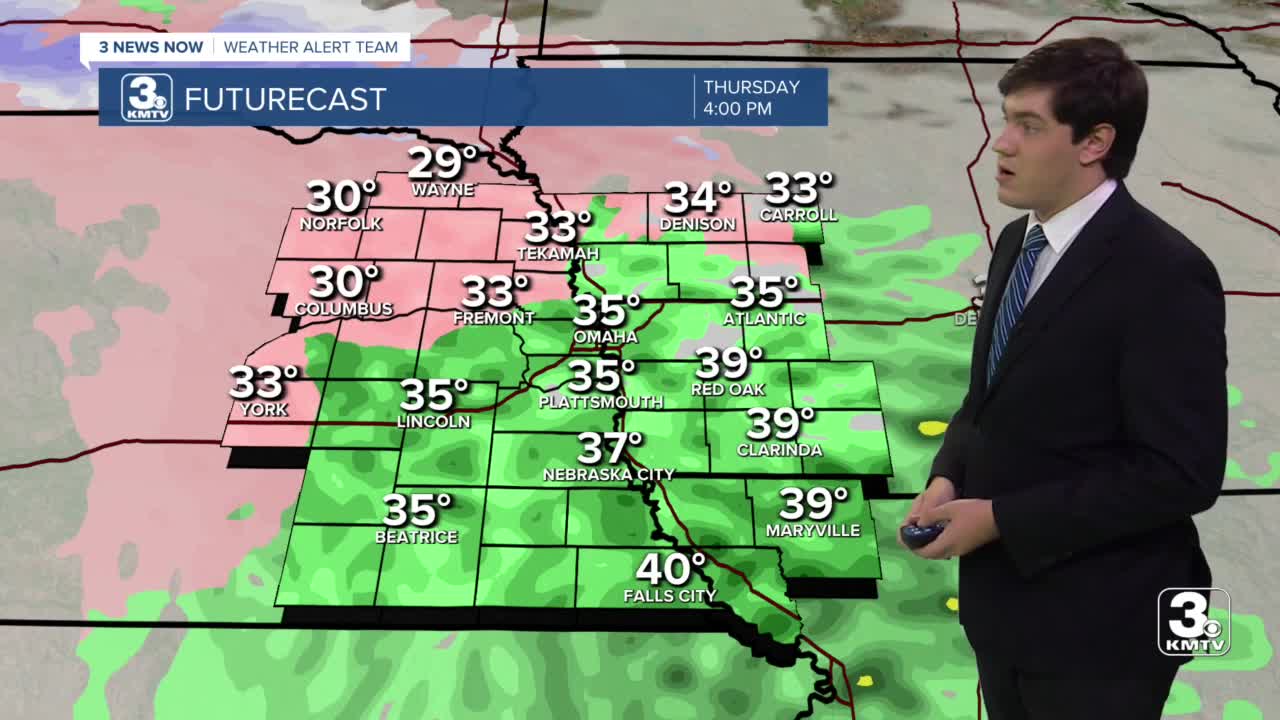
A wintry mix of rain, freezing rain, and snow will start to move into eastern Nebraska Thursday morning, but the current timing should allow a lot of us to have a dry morning commute. Any slight deceleration in the system could change that, though.
Cities towards the Kansas border, northwest Missouri, and the corner of southwest Iowa likely only see rain, but as you get closer to I-80, freezing rain will be possible at times. The greater concern for freezing rain will be along and north of I-80. In Omaha, freezing rain is more likely from late morning to early afternoon. By late afternoon, Omaha should warm into the upper 30s, turning the freezing rain potential to regular rain. North of Omaha, where it will be slightly colder, the freezing rain threat will continue later in the afternoon.
Northeast Nebraska will be cold enough to mainly see snow through the day. Accumulations there could be 1 to 3 inches.
We're dry Friday, but it stays mostly cloudy with highs in the upper 30s.
Clouds will be stubborn on Saturday as we dodge a few pockets of light rain and snow, but most of us stay dry. Highs will be in the low 40s.
Sunday brings a little more sunshine mixing in with the clouds with highs in the low 40s again.
Rain moves back in Monday and Tuesday with more wind and highs in the mid 40s. Some of that rain could try to change into snow late Tuesday.
THURSDAY
Cloudy
Rain, Freezing Rain, Snow
High: 35
THURSDAY NIGHT
Cloudy
Drying Out
Low: 27
FRIDAY
Mostly Cloudy
Cool
High: 39
SATURDAY
Mostly Cloudy
Slight Rain/Snow Chance
High: 41
Share your weather pictures with KMTV:
- Email to News@3newsnow.com
- 3 News Now Facebook page
- Use the hashtag #3NewsNow on Instagram or Twitter
Download the free Storm Shield app for ANY type of phoneReceive severe weather watches and warnings for your location as you track the storms on radar. Great for use at the office, at home, and while traveling.


