

3 THINGS TO KNOW
- Clouds and some rain on Monday
- More heat midweek
- Staying very dry for the next week
FORECAST
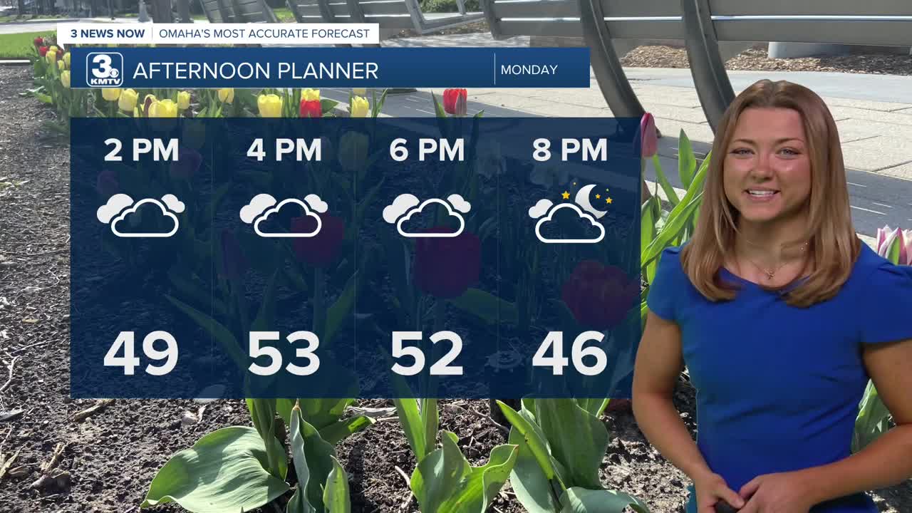
Most of our Monday is going to be covered by some clouds, with temps only reaching the mid 50s - a typical March day.
We do have the potential of seeing some light drizzle this afternoon, but with how little moisture we have available, a lot of that probably won't make its way to the ground.
Once the clouds move on by, we start another warming trend on Tuesday as highs climb back into the 70s.
It will feel like summer again on Wednesday, with highs in the mid-80s.
Another front passes through on Thursday, bringing with it a small chance of rain, more wind, and cooler air.
For the weekend, we will be in the 60s and 70s.
We stay mostly dry for the next 7 days, but there are some early indications that a pattern change may bring the Heartland more active weather by the first week of April.
MONDAY
Mostly Cloudy
Light Rain Chance
High: 54
Wind: SE 5-15
MONDAY NIGHT
Partly Cloudy
Cold
Low: 32
Wind: NW 5-15
TUESDAY
Mostly Sunny
Warmer
High: 72
Wind: SE 5-15
WEDNESDAY
Mostly Sunny
Very Warm
High: 86
Wind: S 5-15
Share your weather pictures with KMTV:
- Email to News@3newsnow.com
- 3 News Now Facebook page
- Use the hashtag #3NewsNow on Instagram or X (formerly Twitter)
