

A cold front arrives today, and although it will be windy, we won't really tap into the cooler weather until Tuesday. We'll see a mix of sun and clouds with highs in the upper 60s.
The wind lightens up some tonight, but it will stay breezy overnight. Tuesday morning will be cooler with mid 40s.
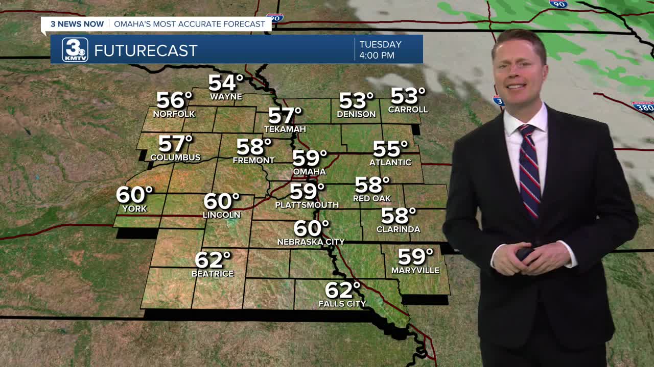
Tuesday will be mostly sunny, windy, and cooler. Highs will be in the upper 50s, putting Omaha a touch below average.
The wind will lighten up into Wednesday morning, which could allow for our first widespread frost across eastern Nebraska and western Iowa. Temperatures will drop down into the mid 30s, which means the air down around your grass and plants could drop below freezing. Protect any sensitive plants you'd like to keep around a little longer.
Wednesday afternoon will be mostly sunny with mid 60s.
Thursday will also start in the 30s. The afternoon will be in the mid 60s with a lot of sunshine.
Friday brings a few more clouds and a small chance for rain. This will cool us into the low 60s.
Saturday brings more clouds than sunshine, keeping us in the low 60s.
We stay mostly cloudy Sunday with mid 60s. Rain is possible late in the day.
MONDAY
Partly Cloudy
Windy
High: 67
MONDAY NIGHT
Mostly Clear
Breezy
Low: 44
TUESDAY
Mostly Sunny
Windy
High: 59
WEDNESDAY
Mostly Sunny
Morning Frost
High: 64
Share your weather pictures with KMTV:
- Email to News@3newsnow.com
- 3 News Now Facebook page
- Use the hashtag #3NewsNow on Instagram or X (formerly Twitter)
