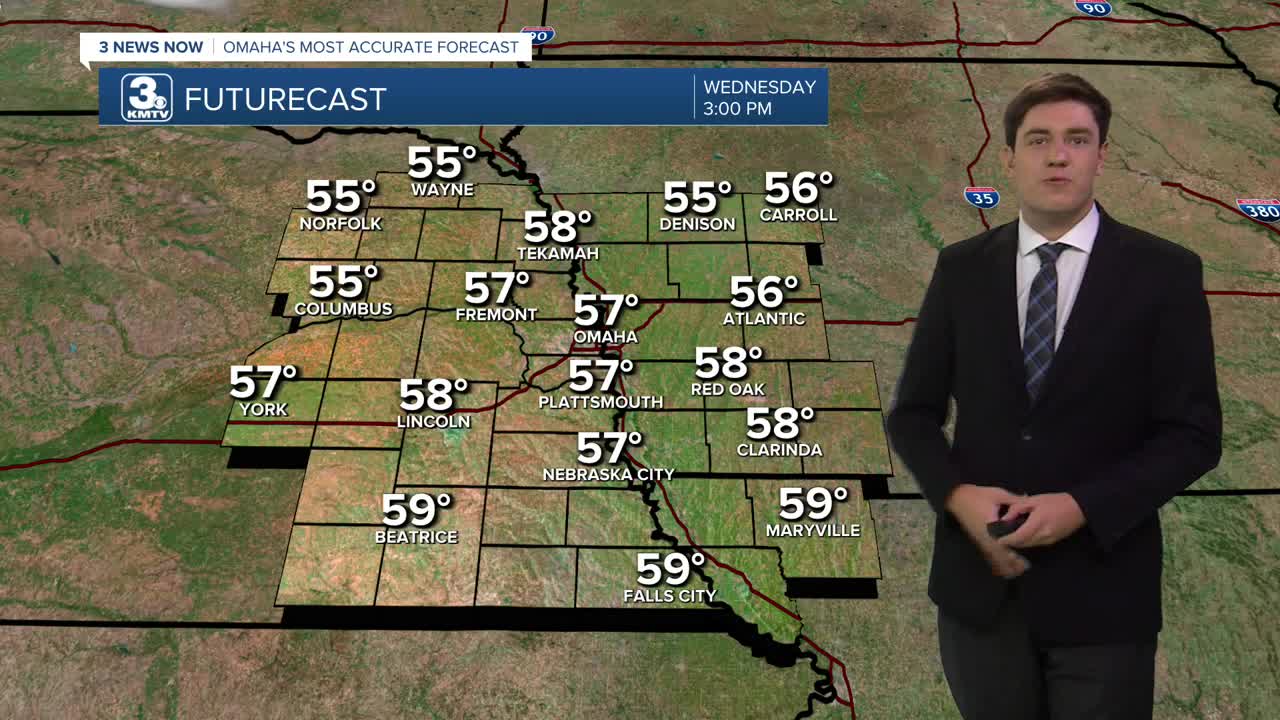


It will be about 10 degrees cooler on Wednesday, but we will get more sunshine. Highs will be in the upper 50s to near 60 degrees.
The wind is expected to become breezy towards the end of the week, and we can anticipate a few more clouds for Thursday and Friday. We stay dry with both days in the mid-60s.
Colder air and rain arrive this weekend. Saturday will be mostly cloudy, and as a storm system moves in, rain will become more likely, especially for the second half of the day. Temperatures vary on Saturday, reaching the 50s near and south of I-80/Omaha, and the 40s north of I-80/Omaha. By Saturday evening, temperatures will be cooling into the 30s.
As the colder air moves in, it may turn some of the cold rain into a spotty rain and snow mix Saturday evening as the rain exits the region. No accumulations or impacts to the region are expected at this time.
It does get very cold heading into Sunday morning. As the skies clear, we drop to around 25 by Sunday morning. Cover any exposed water pipes and disconnect water hoses from your house to prevent freeze damage this weekend.
Sunday will be a very chilly day with mostly sunny skies. Highs will only reach the upper 30s to low 40s, and we will drop in the upper 10s to low 20s for next Monday morning.
However, this cold spell is short-lived, as we return to the 50s & 60s by Tuesday.
WEDNESDAY
Sunny
Cooler
Breezy
High: 57
WEDNESDAY NIGHT
Partly Cloudy
Cold
Low: 38
THURSDAY
Mostly Cloudy
Breezy
High: 63
FRIDAY
Mostly Sunny
Breezy
High: 65
Share your weather pictures with KMTV:
- Email to News@3newsnow.com
- 3 News Now Facebook page
- Use the hashtag #3NewsNow on Instagram or X (formerly Twitter)
