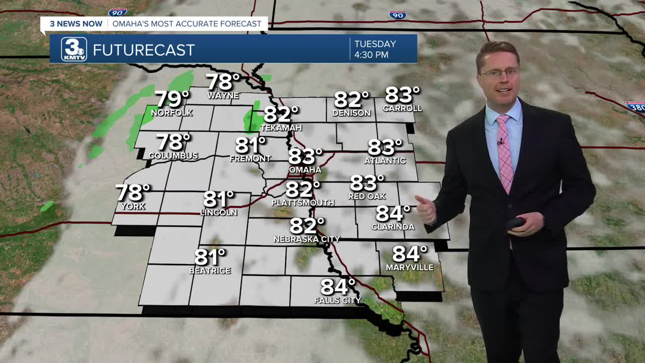


Mostly cloudy skies will help keep the heat under control today, but temperatures will still be above average. Highs will be in the low 80s with slightly lower humidity. Parts of western Iowa will be a touch warmer with mid 80s.
The clouds start to break apart overnight as we cool off into the upper 50s and low 60s across our neighborhoods for Wednesday morning.
Wednesday will bring more of a mix of sun and clouds, pushing temperatures into the mid 80s, which is 10 degrees above average.
The sunshine takes back over Thursday, pushing us into the upper 80s.
We could get back to 90 on Friday with the help of mostly sunny skies and some extra wind out of the south. This will make for some warm Friday night football games. They will kick off in the mid 80s and only cool off to about 80 as they end.
The timing of the weekend cold front is still uncertain, which means the timing of the rain is still uncertain. Right now, it looks like the cold front will still be northwest of our area Saturday. This would leave us partly cloudy, breezy, and warm with upper 80s. But if the cold front gets here a little faster, there would be a chance for some rain, keeping us a touch cooler.
It's more likely the cold front arrives Sunday, which would bring scattered rain and storms in the second half of the weekend. Whenever the rain gets here, it won't be for everyone. Right now, it looks like about half of us will see the rain. Highs will be in the mid 80s for cities that stay dry long enough.
Behind the cold front, we could kick off a stretch of 70s starting on Monday.
TUESDAY
Mostly Cloudy
Not as Hot
High: 83
TUESDAY NIGHT
Partly Cloudy
Comfy
Low: 62
WEDNESDAY
Partly Cloudy
Warmer
High: 85
THURSDAY
Mostly Sunny
Very Warm
High: 88
Share your weather pictures with KMTV:
- Email to News@3newsnow.com
- 3 News Now Facebook page
- Use the hashtag #3NewsNow on Instagram or X (formerly Twitter)
