

3 THINGS TO KNOW
- Cold air begins its move-in Thursday
- Dangerous cold Friday, Saturday
- A chance for snow early this weekend
FORECAST
After a chilly start to the morning, the remainder of the day looks seasonal with partly sunny and breezy conditions with highs in the low 30s. A cold front is expected to pass through this afternoon, bringing frigid air tonight.
Temperatures will dip below zero Friday morning, with wind chills around -30 to -20. The wind will not be overly strong, it's just THAT COLD! You could get frostbite in as little as 30 minutes in this kind of air, so limit skin to outdoor exposure. Bring pets inside, and check on our more vulnerable neighbors.
Friday is the coldest day with a high of around 3, the wind chills will be as low as -15 at times. Friday night will drop below 0 once again.
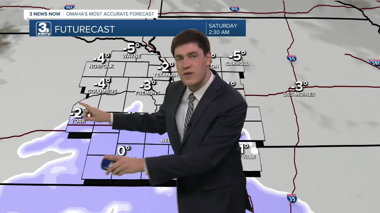
We are growing more confident in light snow moving in from the west Friday evening. This snow will move across the area Friday night, and end by Saturday afternoon. Given the abundance of dry air, snow will probably struggle to fall. However, given the fact it is so cold, the snow that will fall could accumulate fast.
Omaha and neighborhoods to the north will likely see under 2". Totals get higher as you head farther south, with neighborhoods near the Kansas/Nebraska border seeing 2-5".
The rest of the weekend will be frigid and dangerously cold at night as morning temps will be below zero.
By next week, temperatures are expected to start recovering, reaching the 20s on Monday and the 30s by Tuesday.
THURSDAY
Partly Cloudy
Seasonal
High: 30
Wind: NW 10-25
THURSDAY NIGHT
Mostly Cloudy
Frigid
Low: -5
Wind: N 10-20
FRIDAY
Cloudy
Frigid
High: 3
Wind: N 10-20
SATURDAY
Cloudy
Morning Snow
High: 6
Wind: NW 5-15
Share your weather pictures with KMTV:
- Email to News@3newsnow.com
- 3 News Now Facebook page
- Use the hashtag #3NewsNow on Instagram or X (formerly Twitter)
