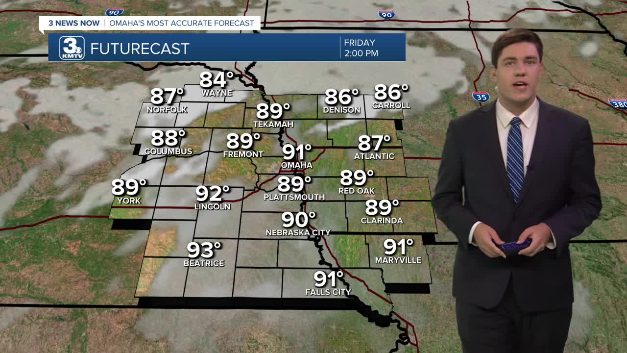


By Friday afternoon, it will be hot, sunny and breezy with low 90s over western Iowa and mid 90s over eastern Nebraska. The wind will be gusting to around 25-30mph. The high humidity will make it feel more like 105+ in the afternoon.
Saturday will be even hotter, with mid-to-upper 90s around Omaha and plenty of sunshine. It will feel like 105+ again in the afternoon. While breezy, the wind will not be as gusty as Thursday/Friday.
Sunday brings a few more clouds, but there will still be plenty of sunshine as we reach the mid 90s. Later in the day, a few showers and storms may bubble up in the afternoon heat and humidity.
Hit-or-miss showers and storms will continue for some of us on Monday as a cold front begins to inch closer to Omaha. Highs will be in the low 90s.
By Tuesday, the cold front will start to move through the region, bringing a slight chance of hit-and-miss rain. It will be partly cloudy with highs in the upper 80s.
Wednesday and Thursday begins the cool-down, and it should begin to be less humid outside by mid-week, too. Highs will be in the mid 80s, followed by low 80s heading into Friday.
FRIDAY
Partly Sunny
Breezy
High: 93
FRIDAY NIGHT
Mostly Clear
Breezy
Low: 74
SATURDAY
Mostly Sunny
Humid
High: 97
SUNDAY
Partly Sunny
Humid
Isolated Storms
High: 94
Share your weather pictures with KMTV:
- Email to News@3newsnow.com
- 3 News Now Facebook page
- Use the hashtag #3NewsNow on Instagram or X (formerly Twitter)
