

Scattered, mainly light, rain will continue across eastern Nebraska and western Iowa through the afternoon. Most of us will see rain at some point today, but there will also be plenty of dry time mixed in. When dry, it will be mostly cloudy and cool with highs in the mid 60s.
Rain becomes less common this evening, but a few spotty showers will still be around overnight and into the Wednesday morning commute with temperatures in the low 60s.
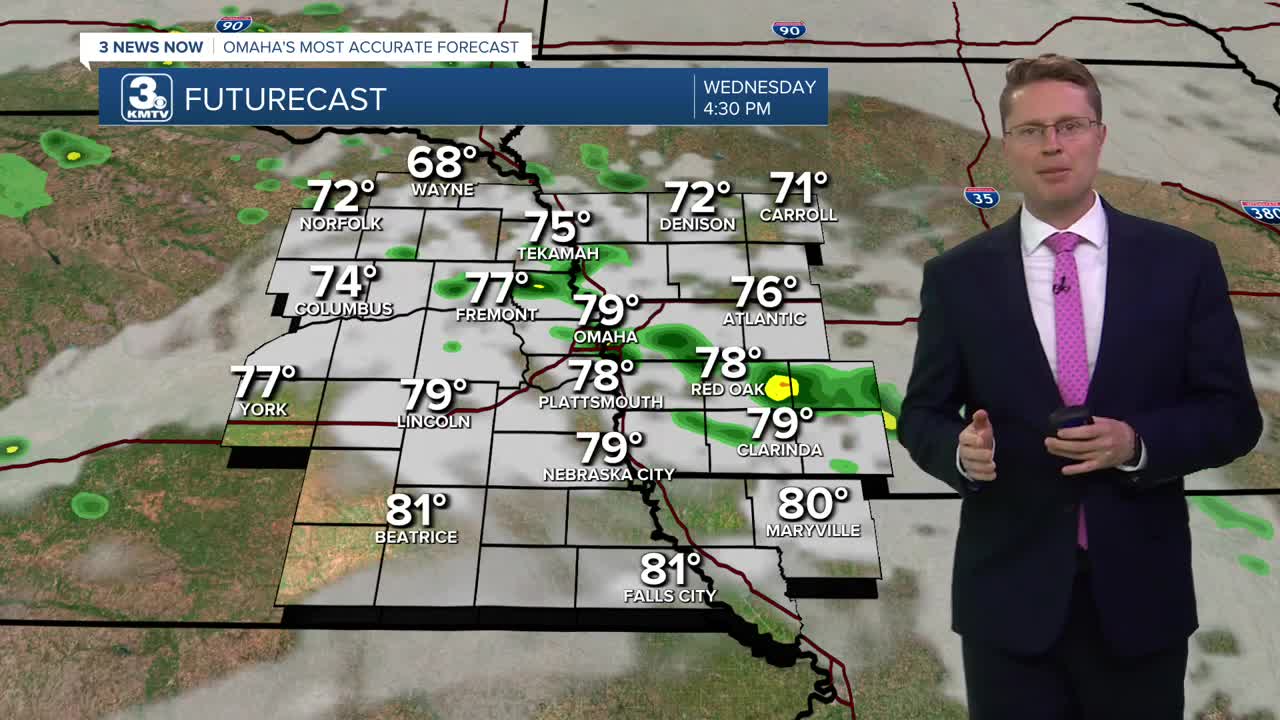
There will be some hit and miss rain around Wednesday, keeping us mostly cloudy, but only about 1/3 of our neighborhoods will see any rain. Even with the clouds, we will start to warm up as a warm front arrives. This will blow in warmer weather, pushing us into the upper 70s in Omaha.
Thursday will be windy and even warmer with low 80s. We'll also see more sunshine during the day. Most of the day will be dry, but a few spotty showers could start to move into eastern Nebraska from the west heading into Thursday night.
Our next cold front arrives Friday, bringing another round of scattered rain. Right now, it looks like about half of us will see rain. The bulk of the rain should fall before high school football kicks off.
Behind the cold front, the sunshine takes over for the weekend as cooler weather blows in. Saturday will be in the upper 60s, followed by mid 60s Sunday.
Monday will be very comfortable with mid 70s and sunshine.
TUESDAY
Mostly Cloudy
Scattered Rain
High: 65
TUESDAY NIGHT
Mostly Cloudy
Hit and Miss Rain
Low: 61
WEDNESDAY
Mostly Cloudy
Spotty Rain
High: 79
THURSDAY
Partly Cloudy
Windy
High: 82
Share your weather pictures with KMTV:
- Email to News@3newsnow.com
- 3 News Now Facebook page
- Use the hashtag #3NewsNow on Instagram or X (formerly Twitter)
