

It will be windy and cooler today, but it will be mostly sunny. Our coolest neighborhoods will be northeast of Omaha with low to mid 50s. The Omaha metro will reach into the upper 50s, and parts of southeast Nebraska will hit the low 60s. This is a touch below average.
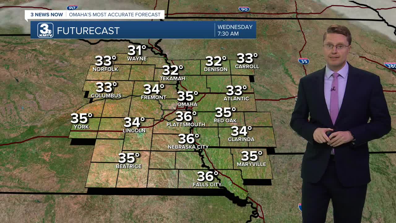
The wind lightens up early tonight, and that will allow our temperatures to drop quickly into Wednesday morning. A lot of cities, including Omaha, will drop into the mid 30s, which is cold enough for frost to form on the ground. So, if you have some sensitive plants you'd like to keep around a little longer, make sure you protect them before heading to bed tonight.
Wednesday afternoon will be mostly sunny with mid 60s, and the wind stays much lighter.
Thursday will also start in the 30s. The afternoon will be in the mid 60s with a lot of sunshine.
Clouds will move back in Friday. A few spotty showers could pop up at any point during the day, but it looks like most of us will be dry. It will be a touch cooler with low 60s.
Saturday will be mostly cloudy with low 60s.
We bump up into the mid 60s Sunday, but we stay mostly cloudy. A few showers could move into eastern Nebraska late in the day, but these won't be common.
Rain will be a little more likely Monday, but there is still a lot of uncertainty with how much rain will make it into our part of the region. It will be mostly cloudy and breezy with mid 60s.
TUESDAY
Mostly Sunny
Windy
High: 59
TUESDAY NIGHT
Mostly Clear
Breezy Early
Frost Possible
Low: 35
WEDNESDAY
Mostly Sunny
Average
High: 63
THURSDAY
Mostly Sunny
Average
High: 65
Share your weather pictures with KMTV:
- Email to News@3newsnow.com
- 3 News Now Facebook page
- Use the hashtag #3NewsNow on Instagram or X (formerly Twitter)
