

WHAT TO KNOW:
- Quiet, cool Thanksgiving Day
- First accumulating snow this season on Friday & Saturday
- Travel delays likely
- Very cold air behind the snow
- Snow flurries possible on Monday
FORECAST:
Thanksgiving Day starts cold, near 20 degrees. It will be a sunny and cold afternoon with highs in the upper 30s, slightly below average for this time of year.
Clouds move in before Friday morning. Around midday, a band of light snow will develop from north to south, mostly across western Iowa. Elsewhere will stay mostly dry until a few hours after midnight. If you are going to Lincoln for the game, no wintry issues are expected.
Air temperatures will slowly warm a few degrees on Friday night, leading to rain beginning in the pre-dawn hours.
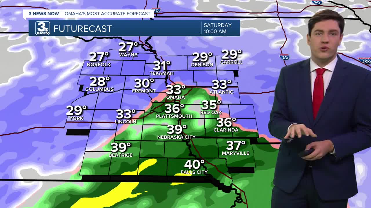
Rain and snow will become more widespread by Saturday morning. Neighborhoods along and south of I-80 will see rain or a rain/snow mix before switching to all snow later in the day. North of I-80 looks to be all snow at this time. The changeover from rain to snow in Omaha will be in the mid-morning, and it's snow for the rest of the day. All snow ends by Saturday night.
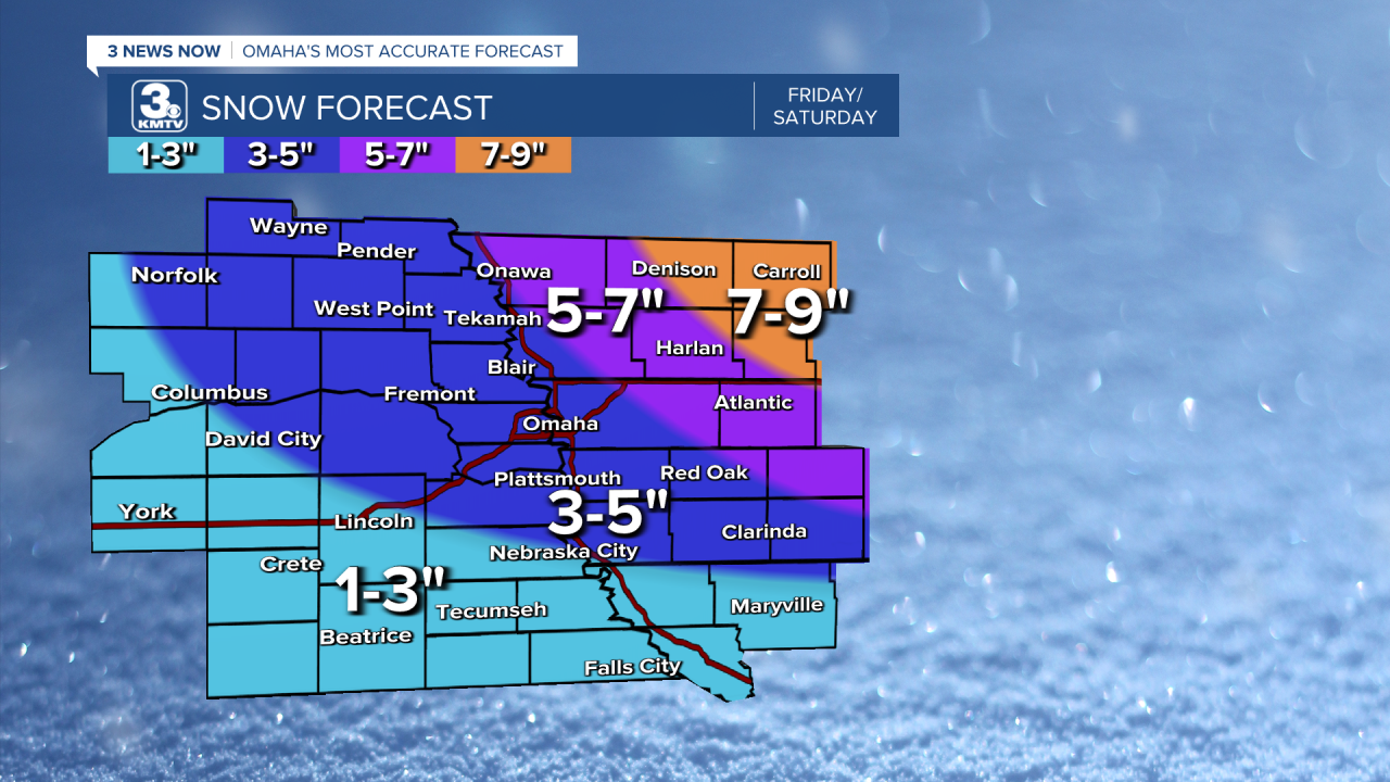
The lowest totals will be across southeast NE, with 1-3" expected. The Omaha metro is in the 3-5" range. In western Iowa, neighborhoods could see up to 5-7". Snow totals will hinge on when the rain/snow transition happens in your neighborhood. If the snow arrives faster than expected in Omaha, we will be on the higher end of the range, but if the rain holds on longer, it might be closer to the low end.
Travel issues are expected Friday night-Sunday, with the worst of it on Saturday, when travel is not advised. Plan for extra time to get where you need to go. Roads will have more snow coverage in Iowa as compared to Nebraska. The wind will be gusty on Saturday as well, which may blow the snow around and reduce visibility.
The cold air with this pattern arrives on Sunday, temperatures drop in the low 20s for Sunday and Monday afternoon. Temperatures at night will dip to near or below 10 degrees.
There is another chance of light snow south of Omaha, closer to the Nebraska/Kansas border, on Monday. At this time, this is not as impactful as the weekend.
Warmer days in the 30s/40s will return towards the end of next week.
THANKSGIVING
Mostly Sunny
Cold
High: 38
Wind: NW 5-10
THURSDAY NIGHT
Partly Cloudy
Calm
Low: 20
Wind: NW 5-10
FRIDAY
Mostly Cloudy
Scattered PM Snow
High: 31
Wind: NW 15-25
SATURDAY
Cloudy
Rain to Snow
High: 30
Wind: NW 15-25 G 35
Share your weather pictures with KMTV:
- Email to News@3newsnow.com
- 3 News Now Facebook page
- Use the hashtag #3NewsNow on Instagram or X (formerly Twitter)
