

3 THINGS TO KNOW
- Severe weather possible Friday
- Cooler, drier over Easter weekend
- More rain chances next week
FORECAST
A few patches of light drizzle litter our late morning and early afternoon, this takes place before some storms line up later.
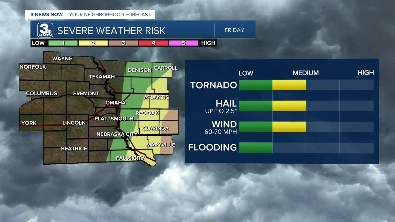
A few stronger thunderstorms may be possible, too. The area with greatest potential for severe weather will be mainly south and east of Omaha, in southeast Nebraska and southwest Iowa, from 2pm until 7pm. Damaging winds, large hail and brief tornadoes may be possible. Elsewhere, including Omaha, we will see mainly rain that lasts through 8-10pm Friday evening.
We won't see much more rainfall on Friday, around another 0.10" to 0.25" will be possible. This will put our totals around 1.00-1.50" in most areas this week!
Easter weekend starts out drier, cool and breezy, with highs on Saturday in the 40s.
A freeze, with frosty conditions is expected Sunday morning with temps in the mid to upper 20s, followed by temps in the upper 50s with sunshine and calmer winds in the afternoon.
Temps will stay near average for early April, in the 50s for the first few days of next week. There is a chance at rain next Monday and Wednesday. Another freeze is possible Tuesday morning.
FRIDAY
Mostly Cloudy
Afternoon Storms
High: 58
Wind: E 15-20
FRIDAY NIGHT
Mostly Cloudy
Chilly
Low: 32
Wind: N 15-20
SATURDAY
Mostly Cloudy
Mild
High: 50
Wind: NW 15-20
Share your weather pictures with KMTV:
- Email to News@3newsnow.com
- 3 News Now Facebook page
- Use the hashtag #3NewsNow on Instagram or X (formerly Twitter)
