

3 THINGS TO KNOW:
- Breezy & above average on Sunday
- Well above-average next week
- Record highs possible on Christmas Day
FORECAST:
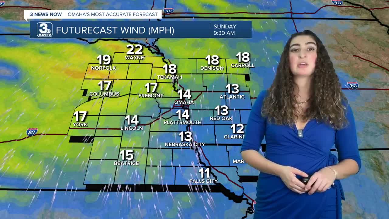
Sunday will be partly to mostly sunny, again reaching the mid 40s. It will be a bit breezy too, which may lead to an elevated fire risk over eastern Nebraska.
Christmas week is looking mild, and much warmer than average for this time of December, when the average highs are now around 36 degrees.
Monday will be mostly sunny and breezy with highs in the mid-50s.
We'll see some extra cloud cover on Tuesday and Wednesday with temperatures in the low 50s.
Christmas Day is Thursday, and Omaha's chance for a "white Christmas" appears near zero...However, we are looking at potential record highs! Right now, we should be near 60 degrees, possibly warmer. The record high for Christmas Day is 57, set in 1946.
The next chance for any measurable precipitation would be the weekend after Christmas. Travel disruptions for the region appear low at this time.
SATURDAY NIGHT
Mostly Clear
Calm Winds
Low: 23
Wind: N 5-10
SUNDAY
Partly Sunny
Above Average
High: 44
Wind: S 5-15
MONDAY
Partly Cloudy
Warm
High: 55
Wind: S 10-20
Share your weather pictures with KMTV:
- Email to News@3newsnow.com
- 3 News Now Facebook page
- Use the hashtag #3NewsNow on Instagram or X (formerly Twitter)
