

While a few leftover showers clip our far western neighborhoods, most of us, including the Omaha metro, are enjoying the sunshine. It will be a touch warmer today with mid 80s, putting us 10 degrees above average.
It stays mostly clear overnight as we cool off into the low 60s for Thursday morning.
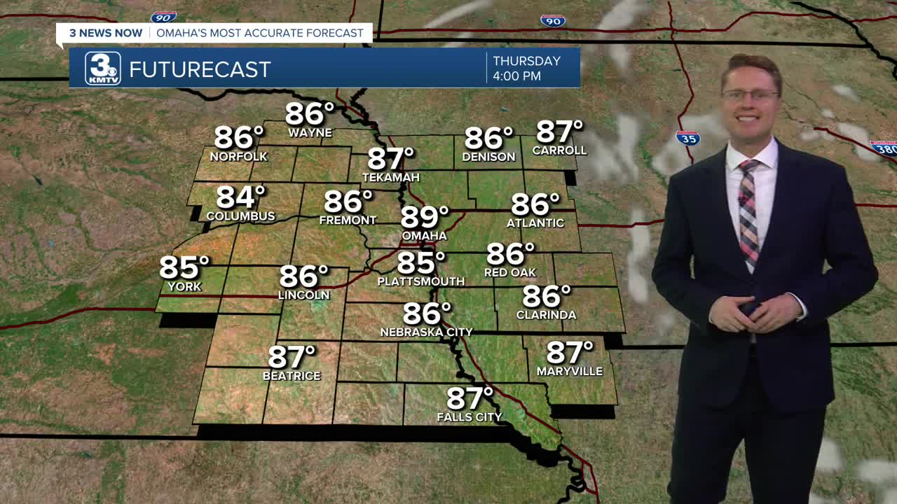
Thursday will be mostly sunny, and we keep heating up, into the upper 80s.
Low 90s are looking more likely for Friday afternoon with the help of mostly sunny skies and a little more wind out of the south. It stays warm for Friday night football. Games will start in the upper 80s and only cool off to about 80 in the 4th quarter.
The wind picks up even more for Saturday, pushing over 30 mph at times. It stays mostly sunny and hot with a high near 90.
A cold front moves in from the northwest Sunday. Before it gets here, we'll likely have time to warm up into the mid 80s with a mix of sun and clouds. Later in the day, the cold front will kick off some hit and miss showers and storms, but only about half of us will see the rain.
Hit and miss showers and storms will continue for some of us Monday as the cooler weather moves in behind the cold front. Highs will only be in the low 70s!
The low 70s continue Tuesday with at least a small chance for rain.
WEDNESDAY
Mostly Sunny
Warmer
High: 86
WEDNESDAY NIGHT
Mostly Clear
Comfy
Low: 62
THURSDAY
Mostly Sunny
Very Warm
High: 89
FRIDAY
Mostly Sunny
Breezy
High: 91
Share your weather pictures with KMTV:
- Email to News@3newsnow.com
- 3 News Now Facebook page
- Use the hashtag #3NewsNow on Instagram or X (formerly Twitter)
