

A few spotty showers and storms will continue to drift north the rest of the day, keeping us mostly cloudy, but a majority of us will be dry all day. The best chance of seeing some of the rain will be along and south of I-80. Highs will be in the mid 80s.
Spotty showers will continue overnight and into early Saturday morning, mainly southeast of Omaha. This will make for a mostly cloudy start to Saturday with low 70s.
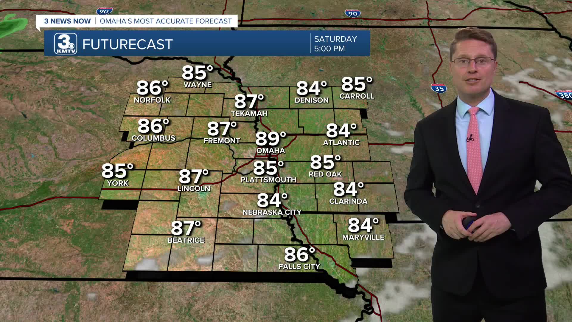
The sunshine takes over Saturday afternoon, and we start to heat back up. Highs will be in the upper 80s, but the humidity will make it feel like the upper 90s.
Sunday will be hotter and mostly sunny with mid 90s. The very high humidity will push the heat index closer to 110.
If you have outdoor plans over the weekend, make sure you take it easy and stay hydrated. Continue to check on your older neighbors, family members, and friends to make sure they are staying cool and safe. Pets should be inside with you where it is cooler with access to clean water all day.
The heat continues Monday with upper 90s and a lot of sunshine. A couple spotty storms are possible heading into Monday night, but that chance is pretty small.
A cold front will slowly slide in from the north some time around Tuesday and Wednesday, bringing a better chance for showers and storms. We likely have enough time to hit the low 90s Tuesday.
Cooler weather should start to move in Wednesday, dropping us into the mid 80s.
Depending on how quickly the cold front moves to our south, there could be some rain still around Thursday. With cooler air still blowing in, we may only reach the upper 70s in the afternoon!
FRIDAY
Mostly Cloudy
Spotty Rain/Storms
High: 84
FRIDAY NIGHT
Mostly Cloudy
Spotty Showers
Low: 71
SATURDAY
Clearing Skies
Isolated Rain
High: 89
SUNDAY
Mostly Sunny
Humid
High: 95
Share your weather pictures with KMTV:
- Email to News@3newsnow.com
- 3 News Now Facebook page
- Use the hashtag #3NewsNow on Instagram or X (formerly Twitter)
