

3 Things to Know
- Evening rain moves out
- Flooding/strong storms possible Saturday night
- Below average temps, and some dry time, for Father's Day
Forecast
Some rain showers are ongoing south and west of Omaha this evening. These should move south of the area by sunset, and we are dry through the night as lows fall into the low 60s.
There will be lots of dry time Saturday morning through the early afternoon. Temps will warm into the low 80s with some extra mugginess.
The CWS Game has been moved up to 2 pm, and should start dry. Storms will develop over central Nebraska and move into the area, possibly pressing into the Omaha metro after 4 pm.
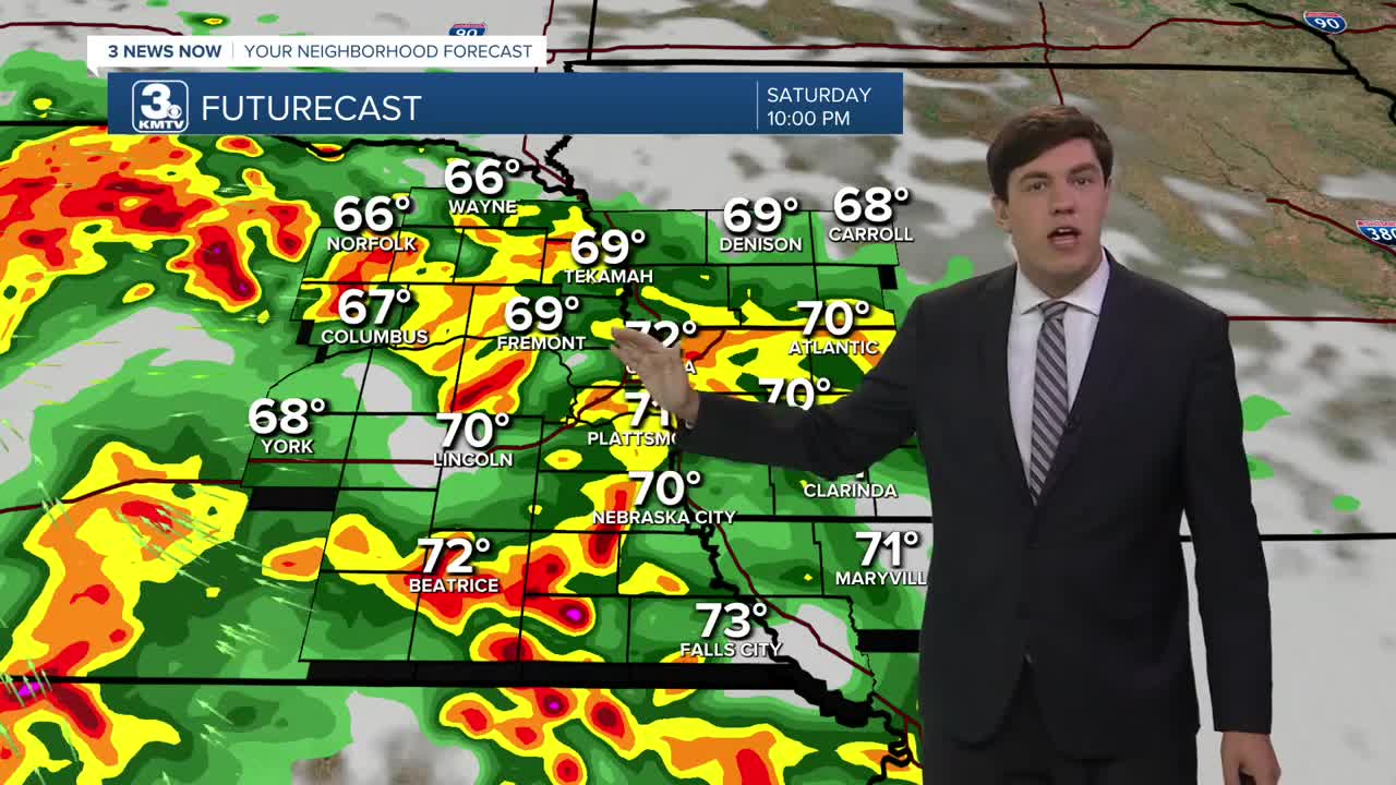
Storms become widespread Saturday night. A few storms could be strong with some gusty winds, but the overall severe risk may end up just southwest of the Omaha area. The bigger concern could be flooding, as storms could drop 1-2" of rain over a wide area, with some localized spots up to 4". On an already saturated ground, this could lead to some flooding. Avoid flooded roadways, and heed any warnings issued.
Sunday may start wet before 10 am. Some light rain will linger for the rest of the day under cloudy skies, but we do trend drier by the afternoon. Temps will only reach the mid-70s.
Next week continues this stretch of cooler-than-average weather as temps only reach the upper 70s to low 80s Monday-Wednesday. The weather pattern remains a bit unsettled with a low-end chance of daily rain/storms.
FRIDAY NIGHT
Partly Cloudy
Comfortable
Low: 62
Wind: NE 5-10
SATURDAY
Mostly Cloudy
PM Storms
High: 79
Wind: SE 5-10
SUNDAY
Mostly Cloudy
Morning Rain
PM Dry Time
High: 73
Wind: NE 5-25
Share your weather pictures with KMTV:
- Email to News@3newsnow.com
- 3 News Now Facebook page
- Use the hashtag #3NewsNow on Instagram or X (formerly Twitter)
