

Now that the fog has cleared, the rest of the day will be mostly sunny, hot, and humid. Highs will be near 90 this afternoon, but it will feel more like 96 in Omaha by the end of the afternoon.
Overnight, we will cool off into the upper 60s for Thursday morning. A few foggy areas with low visibility are likely again.
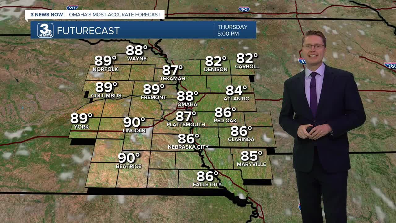
We stay mostly sunny Thursday afternoon with upper 80s.
Friday will start with a lot of sunshine, then we start to see a few more clouds pop up in the afternoon as our next cold front begins to move in from the northwest. As the cold front arrives in the evening and night, scattered storms will become more common. The storms won't be for everyone, but more than half the region should see some rain. A couple of the storms could reach severe levels with strong wind and a few pockets of hail possible.
Behind the cold front, much cooler and less humid weather will move in for the weekend. Saturday will be partly cloudy with highs in the low 80s. There could be a couple leftover spotty showers in the region, but most of us will be dry.
Sunday will be in the upper 70s with a lot of sunshine and low humidity. An isolated shower could pop up during the day, but most stay dry.
Thanks to the lower humidity early next week, our mornings will be able to cool off into the 50s in Omaha! Neighborhoods farther north and into southwest Iowa could even wake up to 40s.
Monday and Tuesday afternoons will be mostly sunny with mid 70s.
WEDNESDAY
Mostly Sunny
Humid
High: 90
WEDNESDAY NIGHT
Mostly Clear
Foggy Areas
Low: 67
THURSDAY
Mostly Sunny
Humid
High: 88
FRIDAY
Partly Cloudy
Scattered Storms Late
High: 88
Share your weather pictures with KMTV:
- Email to News@3newsnow.com
- 3 News Now Facebook page
- Use the hashtag #3NewsNow on Instagram or X (formerly Twitter)
