

The hot weather continues today! We stay mostly sunny as we push into the low 90s. Thankfully, the humidity isn't nearly as bad as it could be. High school football games will kick off in the mid 80s and only cool off into the upper 70s for the 4th quarter.
The wind begins to pick up into Saturday morning, which will help make for a warm start to the day. We only cool off into the upper 60s overnight.
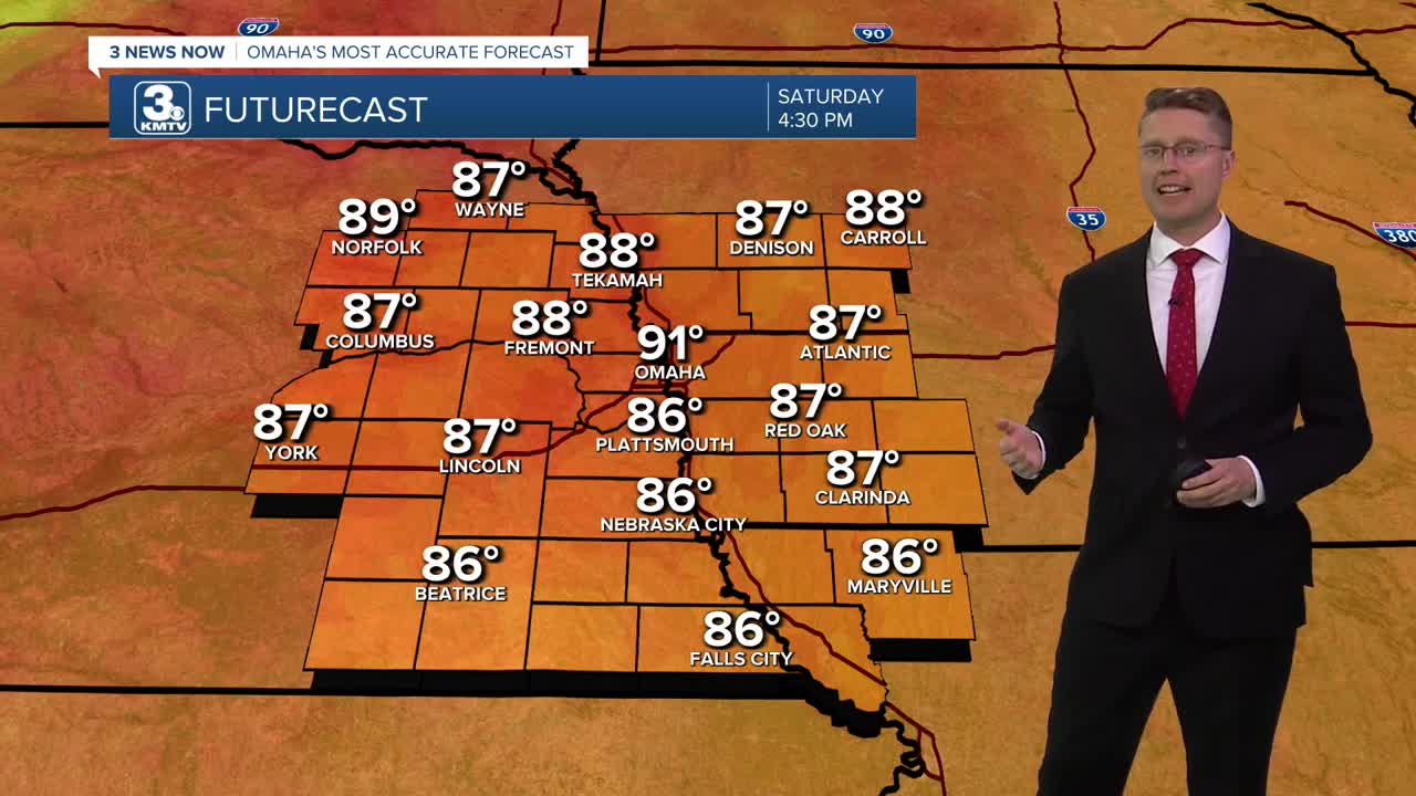
Saturday will be windy with speeds of 20-40 mph. The wind will be out of the south, keeping the hot weather in place. It will be mostly sunny with highs in the low 90s, likely falling just shy of the record high for October 4 of 92 from 2005.
A cold front will move in from the northwest Sunday. Before it gets here, we'll likely warm up into the mid 80s with a mix of sun and clouds and stronger than normal wind. The cold front could kick off a couple isolated showers or storms earlier in the day, but rain becomes more likely in the evening and night. The rain and storms will be scattered, so only about half of us will see rain Sunday, but it will be more common the farther south and east you live in the region.
Scattered showers and storms will continue Monday with about half of eastern Nebraska and western Iowa seeing more rain. Everyone will be a lot cooler! Omaha will only reach the upper 60s in the afternoon.
Any leftover rain should end early in the morning, then we see some sunshine start to come out Tuesday afternoon. It will be comfortable with low 70s.
Wednesday looks great with mostly sunny skies and low 70s!
It gets a little breezy again Thursday with low 70s, a few more clouds, and at least a small chance for rain.
FRIDAY
Mostly Sunny
Hot
High: 92
FRIDAY NIGHT
Mostly Clear
Warm
Low: 68
SATURDAY
Mostly Sunny
Windy
Record: 92 (2005)
High: 91
SUNDAY
Partly Cloudy
Breezy
Scattered Rain/Storms
High: 86
Share your weather pictures with KMTV:
- Email to News@3newsnow.com
- 3 News Now Facebook page
- Use the hashtag #3NewsNow on Instagram or X (formerly Twitter)
