

The hot weekend weather continues into the workweek. We stay mostly sunny the rest of the day will highs in Omaha flirting with 90.
It stays warm (for September) overnight, only cooling off into the upper 60s for Tuesday morning.
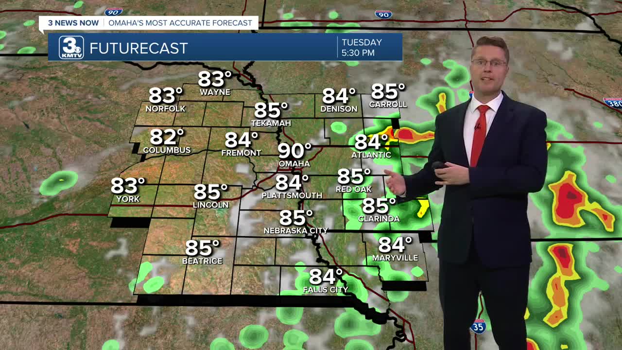
Tuesday will be mostly sunny and hot with highs near 90 again. By the end of the afternoon, a couple isolated showers and storms will start to pop up, but more of us will get hit by scattered rain and storms heading into Tuesday night.
Showers and storms are likely at times Wednesday, but there will be some dry time mixed in. The rain and extra clouds will help keep us cooler with highs in the upper 70s.
The slow-moving area of low pressure will continue to brings scattered showers and storms to many of us Thursday. Highs will be in the mid 70s.
There won't be as many showers and storms around Friday. About half of our neighborhoods will see rain to end the workweek with mid 70s.
We continue to slowly dry out Saturday. About 1/3 of the region will get hit by the leftover scattered rain and storms. Temperatures stay a touch below average, in the mid 70s with mostly cloudy skies.
Sunday looks dry with more sunshine and upper 70s.
MONDAY
Mostly Sunny
Muggy
High: 89
MONDAY NIGHT
Mostly Clear
Warm
Low: 67
TUESDAY
Mostly Sunny
Spotty Storms Late
High: 90
WEDNESDAY
Mostly Cloudy
Rain & Storms
High: 79
Share your weather pictures with KMTV:
- Email to News@3newsnow.com
- 3 News Now Facebook page
- Use the hashtag #3NewsNow on Instagram or X (formerly Twitter)
