

3 Things to Know
- Another hot day in the 90s Wednesday
- Storms possible early Thursday morning
- Temps to dip a little!
Forecast
Our overnight lows didn't even dip below 70 degrees last night! That's making for a pretty warm start to our Wednesday morning, with the addition of some lingering isolated storms.
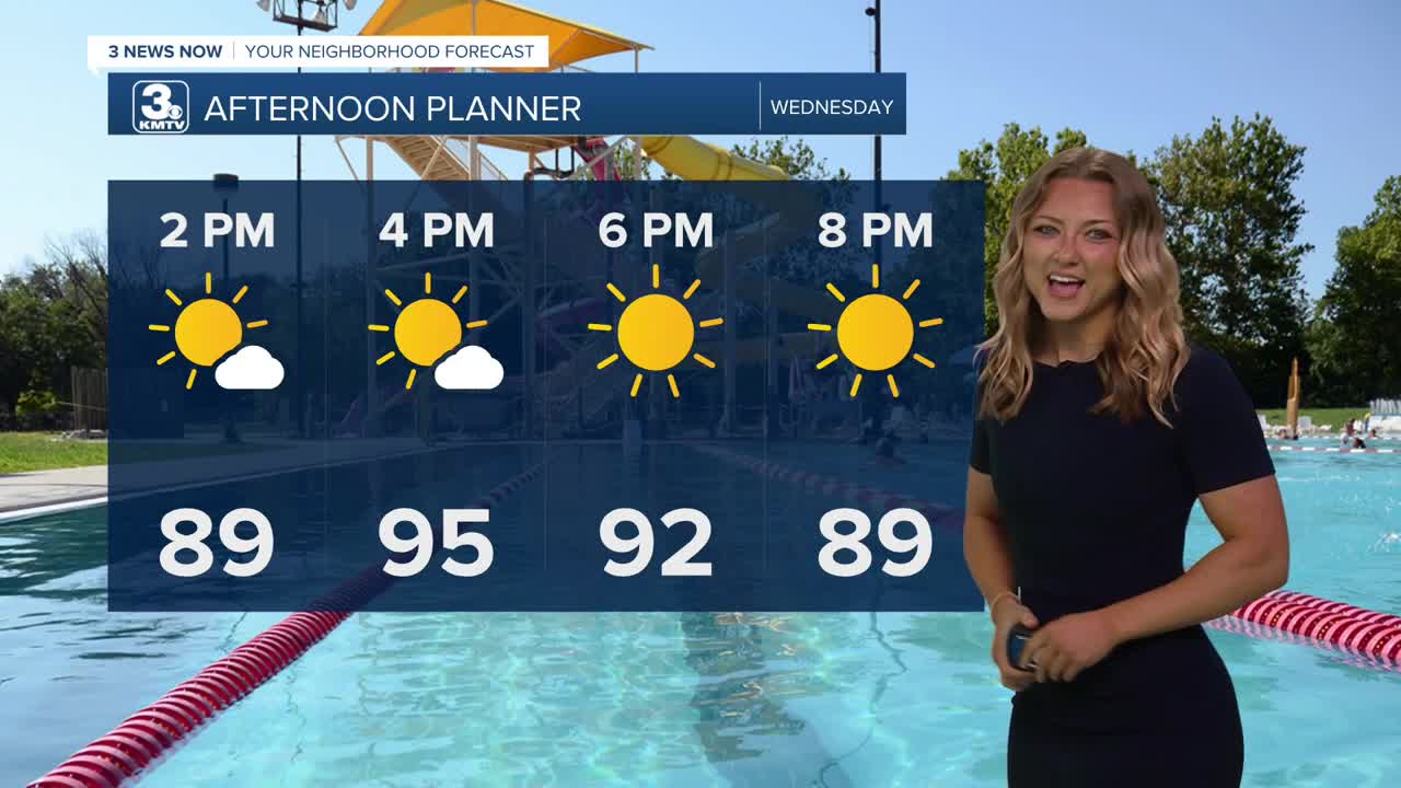
Dew points (moisture) will be a little lower on Wednesday, but it will still be very hot out with mostly sunny skies and highs in the low to mid 90s. The afternoon heat index will be around 95-100.
After around midnight on Wednesday night, a cold front will begin to move into the region, kicking off widespread thunderstorms into early Thursday morning. There is a chance at severe weather in the morning, but the greater concern is flash flooding, with the potential of 1-3" of rain Thursday morning.
Thursday's rain will clear out early in the afternoon and we finish the day with some sunshine. Highs will only be in the low 80s and nightly temps will cool into the upper 50s!
Friday is looking like a great day for the start of the Men's College World Series! It will be a mostly sunny day with highs in the mid 80s.
Rain is back in the forecast though as early as Saturday, and severe storms may be possible later in the day. We'll keep the rain chances around for Sunday and Monday, too.
WEDNESDAY
Mostly Sunny
AM Storms
High: 95
Wind: SE 15-25
WEDNESDAY NIGHT
Humid
Stormy
Low: 75
Wind: SE 10-15
THURSDAY
AM Storms/PM Sun
Heavy Morning Storms
High: 82
Wind: NW 10-20
Share your weather pictures with KMTV:
- Email to News@3newsnow.com
- 3 News Now Facebook page
- Use the hashtag #3NewsNow on Instagram or X (formerly Twitter)
