

The rain kept Omaha cooler Monday, but with mostly sunny and dry skies today, we'll be warmer with mid 80s. The humidity will also be climbing through the day.
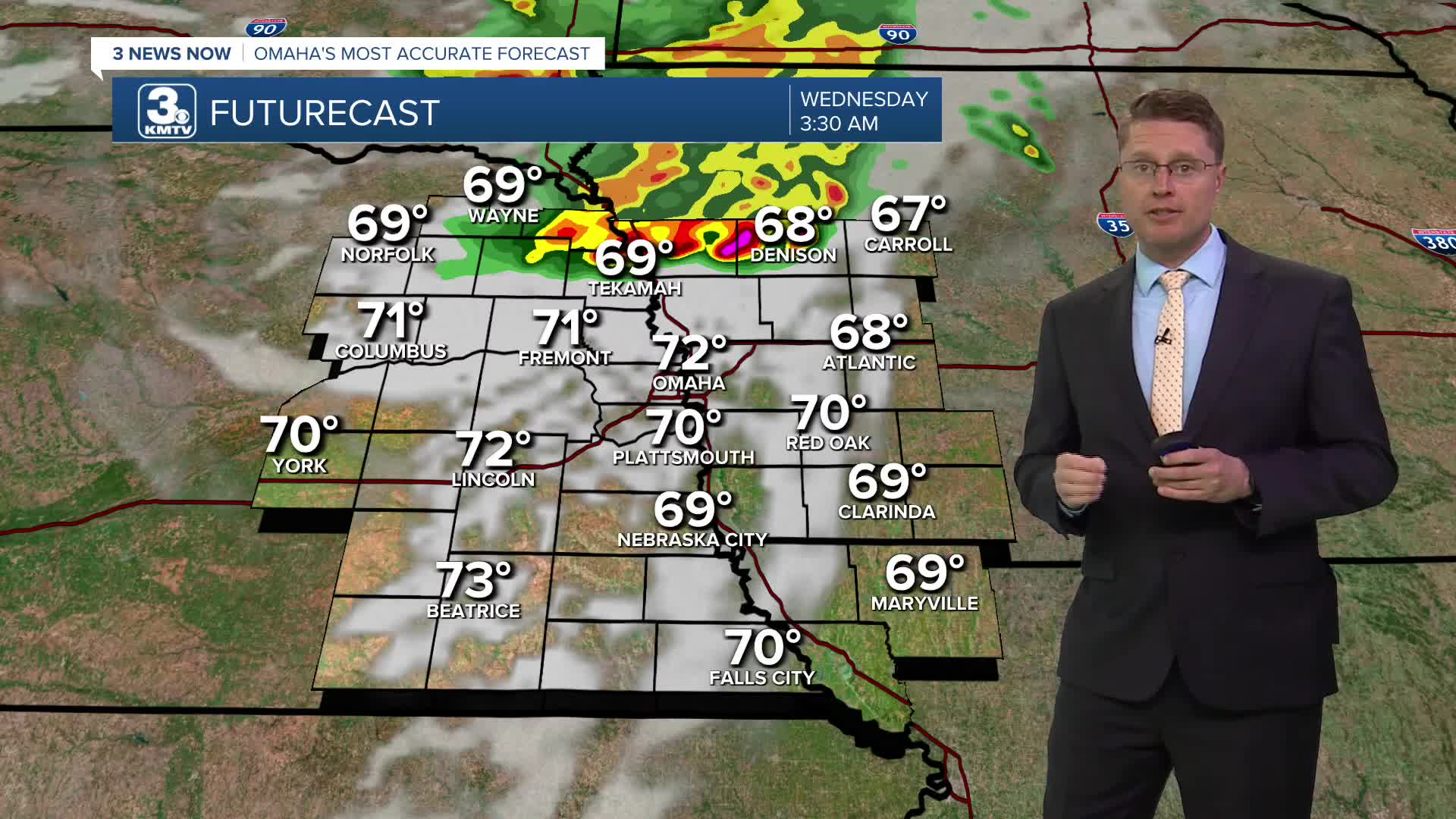
Overnight, scattered storms will arrive from the north. A couple of these could be strong enough to produce some strong wind and a couple pockets of hail. Some of the storms will likely continue into the Wednesday morning commute, but there will be plenty of dry areas to start the day too. Temperatures will be in the upper 60s in the morning.
A few hit and miss storms will continue into Wednesday afternoon, but a lot more of us will be dry for the second half of the day. The dry areas will be partly cloudy with upper 80s. It will also be a bit breezy at times with winds around 15-25 mph.
Thursday could also start with a few hit and miss showers and storms, but about half of eastern Nebraska and western Iowa will be dry all day. The afternoon brings more sunshine. It will be breezy and humid with low 90s.
Friday will be mostly sunny and breezy with mid 90s across eastern Nebraska and low 90s across western Iowa.
The weekend rain is trying to slow down. It looks like we'll be dry long enough now Saturday to push into the low 90s. Then, late Saturday and into Sunday, showers and storms will become more likely. Although, if the slowing continues, more of this could land on Sunday vs. Saturday.
Sunday won't be as hot with highs in the mid 80s.
The mid 80s continue Monday with a small chance for rain.
TUESDAY
Mostly Sunny
Muggy
High: 84
TUESDAY NIGHT
Partly Cloudy
Scattered Storms
Low: 68
WEDNESDAY
Partly Cloudy
Scattered Storms
Breezy
High: 87
THURSDAY
Partly Cloudy
Spotty Storms
Breezy
High: 91
Share your weather pictures with KMTV:
- Email to News@3newsnow.com
- 3 News Now Facebook page
- Use the hashtag #3NewsNow on Instagram or X (formerly Twitter)
