

3 THINGS TO KNOW
- Continuing with above average highs
- Extra clouds later in the week
- Slight chance at weekend rain
FORECAST
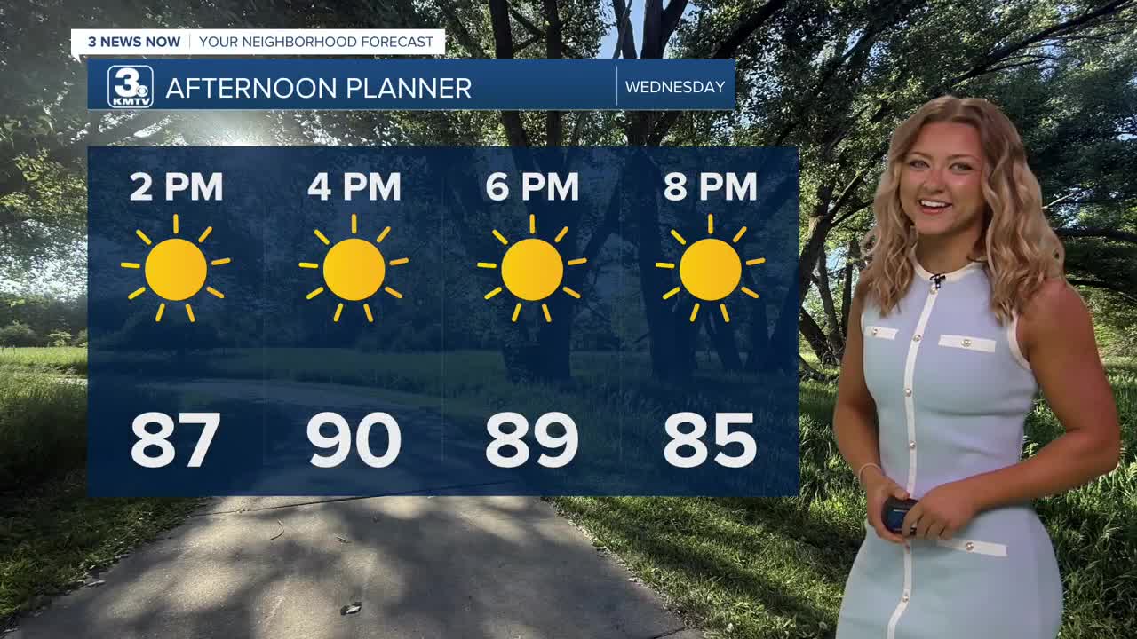
It's going to be another dry, hot day for our Wednesday with afternoon highs back into the 90s.
A few extra clouds will roll in Thursday, but our skies look to stay partly to mostly sunny with highs in the upper 80s.
Some spotty rain will try and clip parts of central and eastern Nebraska on Friday and Saturday. Saturday morning brings some shots we have at some scattered storms, with rainfall amounts for the metro forecasted to stay under a half of an inch. Due to even more cloud cover, highs will be in the mid 80s.
Our best chance at rain comes Sunday, but it does look like there will be some dry time through a lot of the day.
We'll continue with spotty, small chances at rain into early next week with high temps for the first days of June in the low to mid 80s. That is around average for this time of year.
WEDNESDAY
Mostly Sunny
Warm
High: 90
Wind: SE 5-15
WEDNESDAY NIGHT
Some Clouds
Mild
Low: 65
Wind: S 5-15
THURSDAY
Partly Cloudy
Warm
High: 86
Wind: SE 10-15
Share your weather pictures with KMTV:
- Email to News@3newsnow.com
- 3 News Now Facebook page
- Use the hashtag #3NewsNow on Instagram or X (formerly Twitter)
