

3 THINGS TO KNOW
- Cloudy, but mild on Tuesday
- Windy and colder starting Wednesday - Sunday
- Small rain & snow chances
FORECAST:
Today is the warmest day of the week by far, with highs in the upper 50s, despite the mostly cloudy sky. We probably won't break any records, but the record high for Omaha is 63 degrees. A cold front is expected to arrive later in the evening, bringing a chance of spotty rain showers from the afternoon through Tuesday night. Once the front arrives, winds will begin to pick up in the evening with 20-30 mph wind gusts.
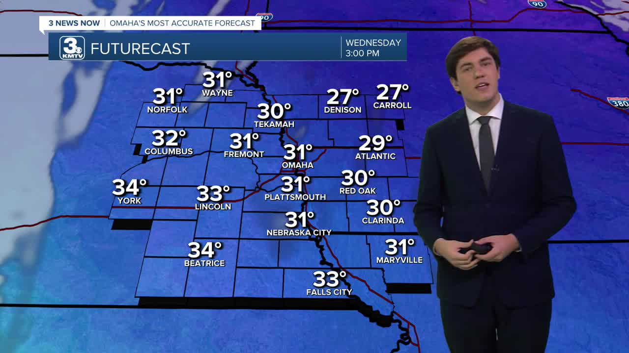
This cold front will bring colder weather into the region starting Wednesday, with highs in the low 30s and sunny skies. This cold weather looks here to stay, with near-to-below average temps lasting through the weekend. Wednesday starts windy, but the wind relaxes through the day.
We briefly reach the 40s on Thursday before a second cold front arrives in the evening. This cold front will bring another chance of spotty snow showers Thursday night into Friday, 30-40 mph winds, and more cold air. This chance for snow could bring a dusting of accumulation, but the system likely will have to fight through dry air. We'll monitor it.
By the weekend, temperatures are expected to drop even further, with Saturday forecasted to have highs in the low 20s and lows in the single digits. Sunday may be a bit warmer, but only near 30 degrees.
Warmer weather, in the 30s/40s, should return next week with low chances for rain or snow.
TUESDAY
Mostly Cloudy
Warm & Breezy
Spotty Evening Rain
High: 58
Wind: W 15-25
TUESDAY NIGHT
Mostly Cloudy
Flurries & Breezy
Low: 26
Wind: SW 5-15
WEDNESDAY
Mostly Sunny
Colder & Windy
High: 31
Wind: N 20-30
THURSDAY
Partly Cloudy
Warmer
High: 43
Wind: S 15-25
Share your weather pictures with KMTV:
- Email to News@3newsnow.com
- 3 News Now Facebook page
- Use the hashtag #3NewsNow on Instagram or X (formerly Twitter)
