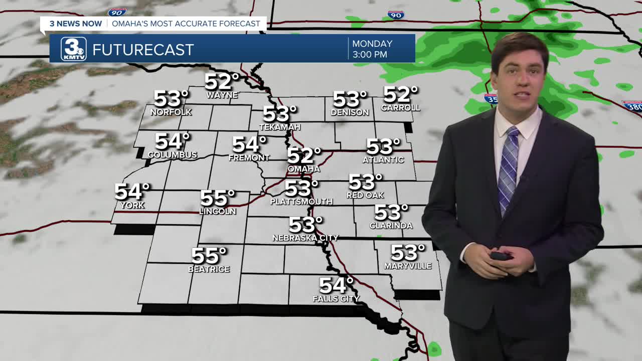


Most of the rain had moved off to the east, but drizzle or light showers could last through the afternoon. Today is also the "warmest" of the next several days, with highs in the mid-50s. Clouds keep our temps in the 40s overnight.
We keep the clouds & start to get colder on Tuesday. Tuesday will also be windy, with some 40-50 mph gusts not out of the question. This could lead to an elevated fire risk, so avoid any outdoor burning.
The sunshine returns on Wednesday, but the cold weather settles in with highs only in the upper 30s.
Thanksgiving looks sunny & chilly with highs in the upper 30s.
Confidence is increasing in a band of light snow moving over Nebraska and Iowa on Friday. The exact timing and amount of snow accumulation (if any) are unclear at this time, but it may impact some travel plans.
A reinforcing shot of colder air arrives by the weekend with highs in the low 30s & lows in the 10s/20s.
Another storm system could aim for the region on Sunday with a rain & snow mix, but any details beyond that are uncertain at this time.
Bottom line, those with travel plans after Thanksgiving need to watch the forecast closely.
MONDAY
Mostly Cloudy
Scattered Rain
High: 52
Wind: SE 5-10
MONDAY NIGHT
Mostly Cloudy
Not as Chilly
Low: 42
Wind: NW 5-15
TUESDAY
Partly Cloudy
Cooler & Windy
High: 47
Wind: NW 20-30 G 45
WEDNESDAY
Partly Cloudy
Cold
High: 38
Wind: SW 5-10
Share your weather pictures with KMTV:
- Email to News@3newsnow.com
- 3 News Now Facebook page
- Use the hashtag #3NewsNow on Instagram or X (formerly Twitter)
