

WHAT TO KNOW:
- The snow is over, but some travel impacts may linger through the afternoon
- Bitter cold on Wednesday night, temps below zero
- Back in the 30s by the end of the week
FORECAST:
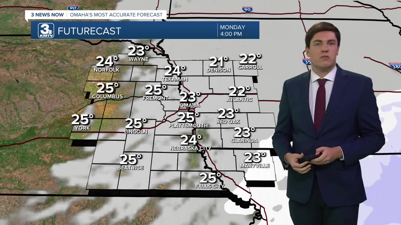
After another snowy morning, the snow exits for most by Monday afternoon, and highs will only reach the lower 20s.
Tuesday may start foggy in some spots, but by the afternoon, it will be a bit "warmer" with highs getting to near 30 degrees. With some sunshine, that should be enough to melt some snow.
A strong cold front on Wednesday will cause the temperatures to be "flipped", meaning we are the warmest in the morning and falling through the day. As you head out to work or school, it will be in the low 30s. As you head home, it will have dropped into the upper 10s.
We bottom out on Wednesday night with lows around -4 degrees, the first time this season we will drop below 0. Thursday morning's wind chill will be down around -10 to -15.
Thursday will be sunny, but cold with highs in the upper 10s.
We slowly climb out of the bitter cold by the end of the week into the weekend, with low 30s on Friday and Saturday.
Another storm system could slide through on Saturday that may bring some rain/snow to the region. At this time, this is not looking as impactful as the winter storm we had this past weekend.
MONDAY
Cloudy
Light AM Snow
High: 23
Wind: S 5-10
MONDAY NIGHT
Mostly Cloudy
Cold
Low: 9
Wind: NW 5-15
TUESDAY
Mostly Cloudy
Not As Cold
High: 33
Wind: S 5-10
WEDNESDAY
Cloudy
Falling Temps
Breezy
AM Temp: 30
PM Temp: 18
Wind: NW 15-25
Share your weather pictures with KMTV:
- Email to News@3newsnow.com
- 3 News Now Facebook page
- Use the hashtag #3NewsNow on Instagram or X (formerly Twitter)
