

3 Things to Know
- Mild Friday!
- Humidity to increase into weekend
- Severe heat and humidity return starting Sunday
Forecast
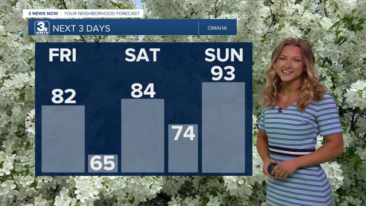
We'll kick start our weekend with a super pleasant Friday. We'll see a little bit more sunshine compared to yesterday, which means temps will probably climb a little higher as well. Expect the lower 80s for our afternoon high today, and pay attention to that UV index if you do get the chance to go outside!
Warm, humid air will begin to blow into the region Saturday. This could lead to a few spotty showers throughout the day. It will be windy and muggy Saturday with highs in the upper 80s, feeling more like the mid 90s.
Severe heat and humidity kick into full gear Sunday. It will be sunny and breezy with highs in the low 90s and a heat index around 105+. That UV index is also set to climb to an extreme 9 on Sunday as well, probably best to spend most times indoors!
This severe heat will continue through much of next week with highs Monday-Wednesday in the low to mid 90s and heat indices around 100-105.
Heading into the 4th of July weekend, it will still be very warm with low 90s for highs, but the humidity may be slightly less oppressive. There are some signals for rain and storms as the summer heat ridge in the jet stream eventually begins to break down around the 4th-7th.
This heat relief may be several days away, but should arrive some time after the 4th of July weekend is over.
FRIDAY
Partly Cloudy
Warmer
High: 82
Wind: S 10-15
FRIDAY NIGHT
Mostly Cloudy
Mild!
Low: 65
Wind: SW 5-10
SATURDAY
Breezy
Small Rain Chance
High: 84
Wind: SW 15-25
- Email to News@3newsnow.com
- 3 News Now Facebook page
Use the hashtag #3NewsNow on Instagram or X (formerly Twitter)
