

3 THINGS TO KNOW:
- Mild weather for New Years Eve, despite some AM fog
- Another cool-down on New Year's Day
- Staying rain and snow-free for a few days
FORECAST:
We drop down into the upper 20s overnight. Some dense fog may develop over western Iowa, with it being more patchy in Nebraska.
Unlike Christmas, we expect this fog to lift off quickly through the morning, leading to a lot of sunshine in the afternoon. This will help to propel temps into the 40s and 50s across the region, with the warmer weather the farther west you live!
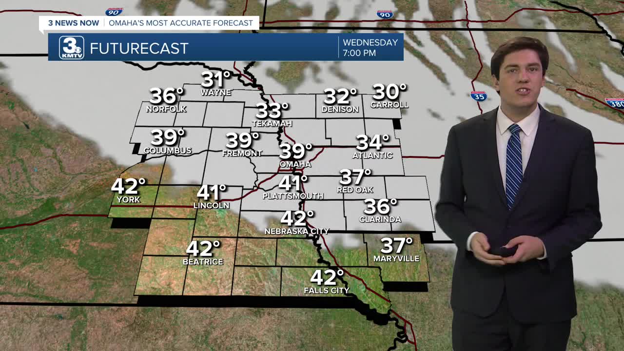
A cool front will bring in some clouds by evening, but this should not impede the downtown Omaha fireworks around 7 pm (temperature: 39 degrees), or any festivities at midnight (temperature: 28 degrees).
This cool front will bring in some colder, more seasonal weather for the New Year, with Thursday and Friday seeing highs in the 30s.
By the weekend, more sunshine will coincide with the warmer weather. Sunday could see highs in the 40s and 50s, and this continues into early next week.
We also enter a dry spell, with no chance for any rain or snow in the next 7 days. Trends indicate that our first precipitation chance will not occur until mid-to-late next week, at the earliest.
TUESDAY NIGHT
Mostly Clear
Patchy Dense Fog
Low: 27
Wind: NW 5-10
NEW YEAR'S EVE
Mostly Sunny
Above Average
High: 45
Wind: NW 5-10
NEW YEAR'S DAY
Partly Sunny
Cooler
High: 34
Wind: NW 5-15
FRIDAY
Mostly Cloudy
Seasonal
High: 34
Wind: S 5-10
Share your weather pictures with KMTV:
- Email to News@3newsnow.com
- 3 News Now Facebook page
- Use the hashtag #3NewsNow on Instagram or X (formerly Twitter)
