

3 THINGS TO KNOW
- More storms on Monday morning
- Next week will be drier and cooler
- Patchy frost on Tuesday night
FORECAST
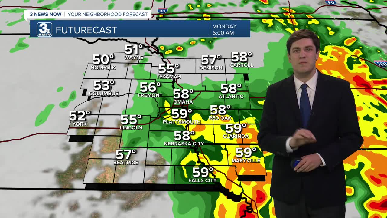
More storms will roll in from the south after midnight. While an isolated strong storm is possible along the Kansas/Nebraska border, these storms should remain below severe levels. These storms will begin to push east by the AM commute on Monday.
A final round of showers and storms pushes through around midday. These should not be severe, but some small hail may develop. Temperatures on Monday will be cooler behind the front, in the 50s, and windy.
A few showers (no storms) could hang around on Tuesday, but we are mostly dry with highs in the upper 50s.
The rest of the week is quiet and on the cool side of things. Lows on Tuesday night may dip into the upper 30s, but any widespread frost potential looks low.
We return to the 60s for the back half of the week. It also looks dry, through we may see a few showers on Thursday.
The trend looks like we will warm up by the weekend, with more dry weather. Our next chance of rain may hold off until early the following week.
MONDAY
Mostly Cloudy
Morning Storms
Windy
High: 57
Wind: SE to NW 20-30
MONDAY NIGHT
Mostly Cloudy
Cool
Low: 41
Wind: NW 5-15
TUESDAY
Partly Cloudy
Small Rain Chance
High: 57
Wind: NW 5-15
WEDNESDAY
Partly Cloudy
Seasonal
High: 65
Wind: NW 5-10
Share your weather pictures with KMTV:
- Email to News@3newsnow.com
- 3 News Now Facebook page
- Use the hashtag #3NewsNow on Instagram or X (formerly Twitter)
