

3 THINGS TO KNOW
- Severe weather possible Friday from 3-9 pm
- Large Hail main concern, but wind & tornadoes are a threat as well
- Dry and pleasant weekend
FORECAST
After a wet start this morning, we should see a few dry hours midday, from 9 am to 2 pm. Some limited sunshine may emerge, raising temperatures back into the upper 60s by early Friday afternoon before the cold front arrives.
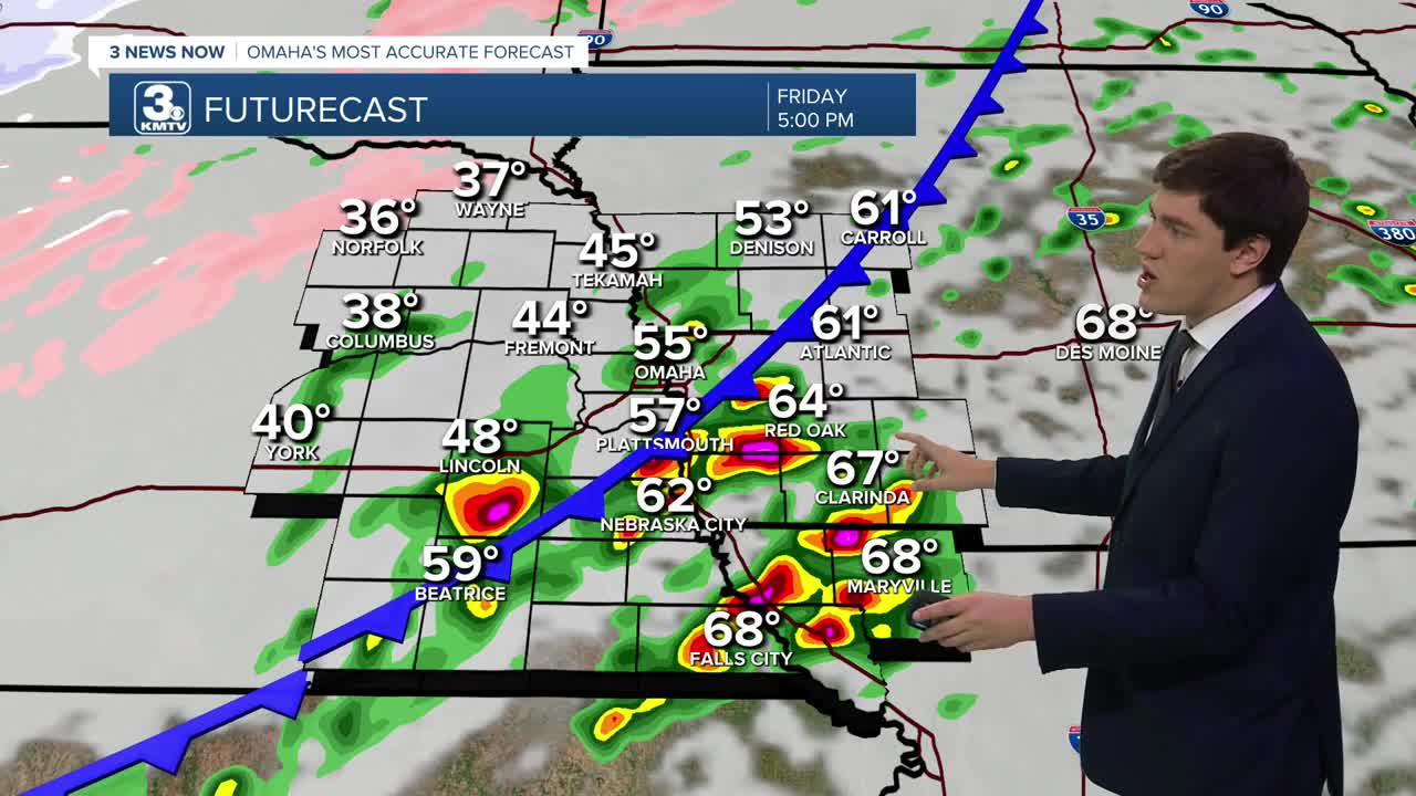
The position of the cold front will be crucial for the afternoon storm threat. By 3 pm, when storms are expected to develop, the front will be close to I-80. This means that storms will develop over Omaha or just to the southeast. The storms increase south of I-80 as the front moves. The storms will clear northwest Missouri by 10 pm.
These storms could become severe with the main threat being large hail up to 2.5". Tornadoes and wind are a secondary, but still real, threat from any storm. A Level 3/5 severe risk has been issued for neighbors in Omaha and south. Lower risks exist north of I-80.
Rain will linger around the region Friday evening, and as sub-32º air moves in over eastern Nebraska, some light snow showers could mix in through midnight-3 am, leading to a quick dusting of snow or ice in northeast Nebraska.
Things will dry out over the weekend, and we see lots of sunshine. Temperatures will be in the 50s on Saturday, then rise to the upper 60s on Sunday.
We start next week with sunshine and temps in the 70s on Monday, followed by more thunderstorms on Tuesday, and some light rain midweek.
FRIDAY
Mostly Cloudy
Scattered Storms
Strong from 3-10 pm
High: 69
Wind: SE 15-25
FRIDAY NIGHT
Mostly Cloudy
Storms Move Out
NE Nebraska Snow
Low: 51
Wind: SE 10-15
SATURDAY
Sunny
Breezy
High: 52
Wind: NW 15-25
SUNDAY
Mostly Sunny
Warm
High: 72
Wind: SW 15-25
Share your weather pictures with KMTV:
- Email to News@3newsnow.com
- 3 News Now Facebook page
- Use the hashtag #3NewsNow on Instagram or X (formerly Twitter)
